Hiking to Stanford Point | Yosemite National Park

Stanford Point Yosemite | Written by Brian Callender | Photography by Julie Boyd

Unrelenting. That’s the feeling that was mutually shared between Julie and I on the hike to Stanford Point. In fact, several times, I found myself wondering aloud, when had we hiked a trail that was this steep. Make no mistake, this hike will kick your butt. From the seemingly never ending stair master to the point, to the knee pain inducing decent, you’ll earn every bit of that post-hike meal.
Stanford Point Yosemite: Hike Details
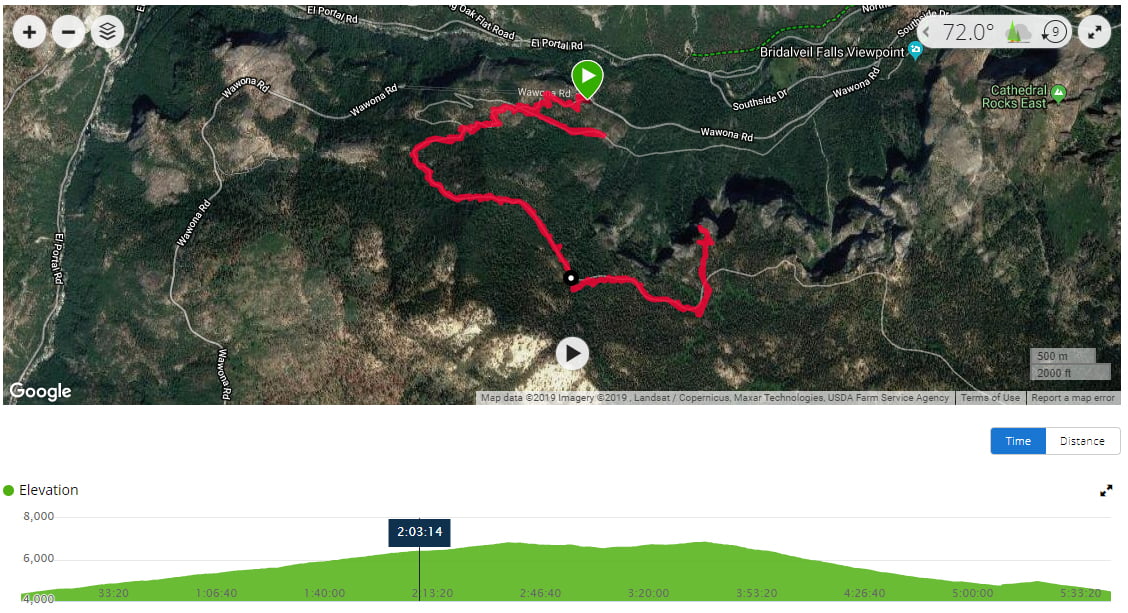
Starting Elevation: 4,344 ft.
Distance: 10.6 miles
Elevation Gain: 2,940 ft.
Hike Type: Out and back, day-hike
.
Difficulty Level: Strenuous
Permit: None required for day hiking
Date Hiked: October 26, 2019

Getting to the Trailhead

The trail to Stanford Point begins at the Tunnel View Overlook parking lot. As with most popular destinations in Yosemite, parking here can be a bit of a challenge. Unless you’re lucky enough to time it perfectly, and we were not, plan to circle a few times before finding a spot. To access the trailhead itself, you will need to be in the parking lot opposite the overlook. A sign at the trailhead does not actually list Stanford Point, but it is between two other listed points, Inspiration and Dewey.
Hiking to Stanford Point Yosemite

Once on the trail, your climb begins immediately with stone steps and a rocky first mile. This was especially fun on our knees coming down!

At 1.3 miles, we reached Inspiration Point and took a quick snack break. The views of the valley are obstructed here, so we found our inspiration and kept moving. We were both glad to have left the rocky section of trail behind, however the next portion of the hike brought some of the steepest incline we can remember in some time.

Straight up, is pretty much the best way to describe the second half of the hike to Stanford Point. While we often feel like most trails will give us sporadic breaks, this trek had none of that. Long stretches of the trail are just a steady incline, with the occasional switchback thrown in to keep you honest. And for the majority of the way, we were in the trees, which was a nice bonus on a blue sky and warm day.

Perhaps the best part of doing this hike in late October was the beautiful array of fall colors that encompassed this hike. Fall is without question the best time to do this trail with an abundance of yellow leaves throughout the hike.
 Once we made it to the top of the tree line, the trail finally gave us some relief, albeit with a caveat. We reached the a market that indicated we had 0.7 miles left to Stanford Point. From here the trail was a combination of downhill and flat, losing about 300 feet of elevation. After having climbed 2,400 to this point, we welcomed the break, knowing full well though, that it would be waiting for us on our return trip.


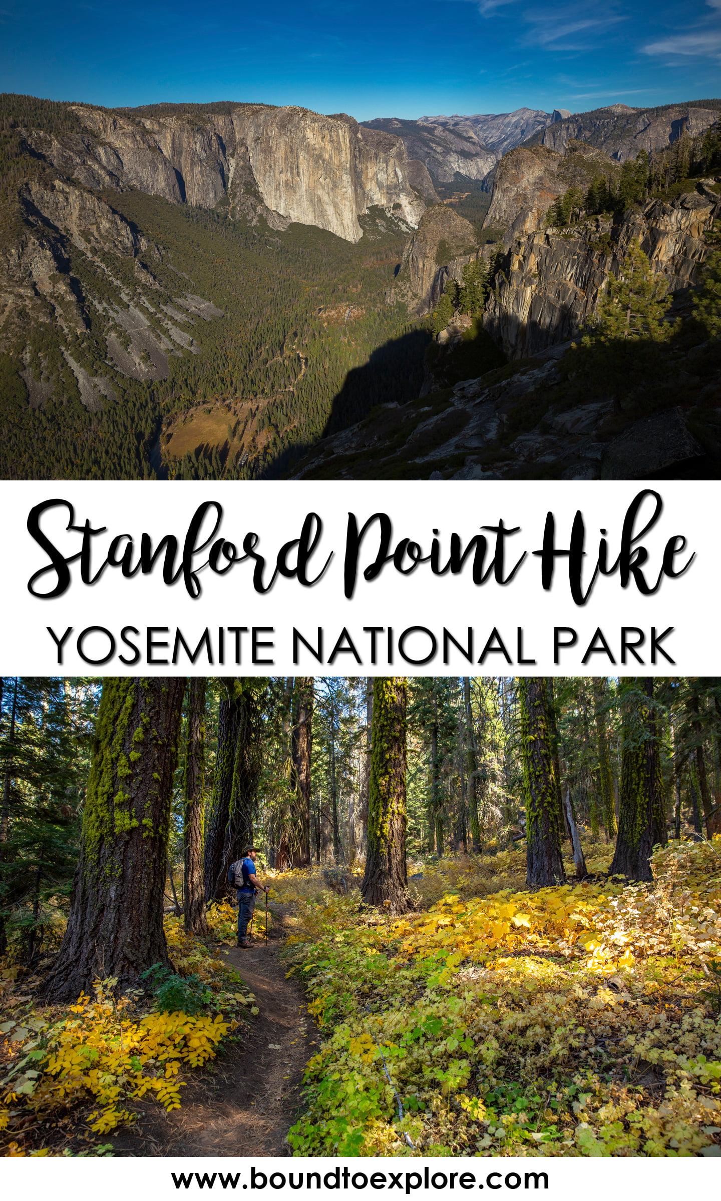
We reached Stanford Point after three hours of hiking and were rewarded with stunning views of Yosemite Valley and Bridalveil Falls. A well placed rock made the perfect spot to enjoy the scenery and eat our peanut butter and jelly sandwiches. After about an hour spent relaxing and capturing photos of Yosemite Valley, we began our return hike. Briefly, we had toyed with the idea of continuing on the additional 0.7 miles to Crocker Point, but decided against it so that we could make it back down for sunset.


As expected, the first part of the hike back meant gaining the elevation we had lost. It’s never especially fun to have to hike up to hike down, but we knew that this brief section would be the only remaining incline for the day.


Sparing the occasional stop for more photos of fall colors, we made good timing coming down the mountain. We took caution not to go too fast on the steeper sections, but the trail almost begs you to run and I could see this being a popular trail run.
Bonus stop: Artist Point Yosemite

Once we passed Inspiration Point, it was about another 0.6 miles to a junction that leads to our next stop: Artist Point. Similar to Stanford Point, the trail to Artist Point is unmarked at the parking lot. It is also not marked at any point along the trail, so having a map handy is key. From the junction, we followed the trail leading to the Bridal Veil Falls parking lot for 0.4 miles. Mostly flat and downhill, the trail appears to have been an old road that has long since been un-maintained. There is no sign for Artist Point, but it’s pretty clear when you reach it. Think of the overlook for Tunnel View, but higher up, with clear views of Yosemite Valley stretching out in front of you. And the best part? No crowds. On this particular night, Julie and I were the only ones at the Point, enjoying the view all to ourselves.

Once the sun had set, we strapped on our headlamps and backtracked to the junction. We were quickly reminded of just how rocky the last 0.7 miles of the trail were and we exercised caution while descending under headlamp light. Back at the car, we threw on our sandals and made the drive into Yosemite Valley where we would be staying for the night.
While we saw a few more people than we had anticipated, this hike is pretty low trafficked, at least by Yosemite standards. If you’re looking for great views, a solid workout, and a less traveled destination, make sure you add Stanford Point to your Yosemite list.
Check out these other awesome hikes in Yosemite:
Glacier Point Hike to Sentinel Dome and Taft Point
Shop our favorite gear for this adventure:
SAVE THIS POST FOR LATER!


As usual the visuals are stunning. Thanks for sharing your fall adventure. It is a relief to know that these beautiful vistas were not destroyed by this summer and early fall fires.