
Minaret Lake Hike | Mammoth, California

Minaret Lake Hike | Words By Julie Boyd |Photos by Julie Boyd and Brian Callender

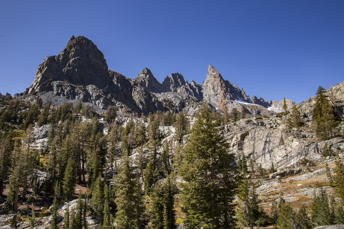
Deep blue waters, nestled in an alpine basin, below craggy spires that seem too jagged to hold themselves up is the reward for the long trek up to Minaret Lake in California’s Sierra Nevada Mountains.
As soon as I saw pictures of this location, I knew Brian and I had to see it in person. While I initially hoped to visit on an overnight trip so that I could capture the early morning on the peaks, we decided that the frigid temperatures during a night in October would be a bit uncomfortable. This destination we so extraordinary though that I am already planning a trip back next summer!
Minaret Lake Hike Details
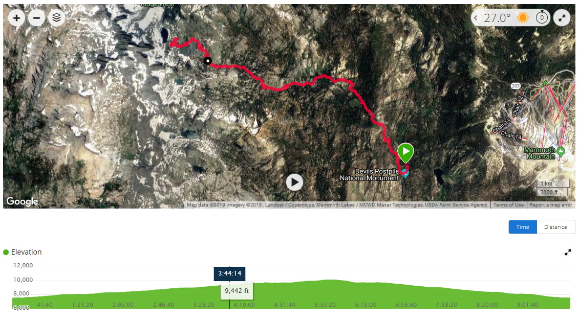
Starting Elevation: 7,549
Distance: 16 miles
Elevation Gain: 3,000 feet
Hike Type: Out-and-back, day-hike, backpacking
Difficulty Level: Strenuous
Permit: None required for day hiking, Wilderness Permit required for backpacking
Date Hiked: October 12, 2019
How to get to the Minaret Lake Trail
The Minaret Lake hike begins in the Devil’s Postpile National Monument near Mammoth Lakes, California. Since the road to this area is closed approximately Mid-October through Mid-June, it is a hike best done during the summer or early fall. Note that during peak season, you will have to take a shuttle from Mammoth Mountain Inn to the trailhead as parking is limited. The National Park Service website has tons of information about parking restrictions, shuttle times, and entry fees. We recommend frequently checking the website before arrival as operating hours vary due to weather.
If you are like us and hate crowds, we recommend doing this hike in the fall just before the Red’s Meadow Road closes for the season. This allowed us to drive down to the trailhead, and enjoy the trek with very few other hikers.
From the Town of Mammoth, take Minaret Road to the entrance of Devil’s Postpile National Monument. If you have time, take a quick stop at Minaret Vista to gaze at your hiking goal for the day. Be sure to bring your National Parks Pass, or pay the current entrance fee, and then make your way down the narrow road toward the Devil’s Postpile Ranger Station. Park here, use the restroom one last time, and be sure to lock away all scented items in the nearby bear lockers.
The Hike to Minaret Lake
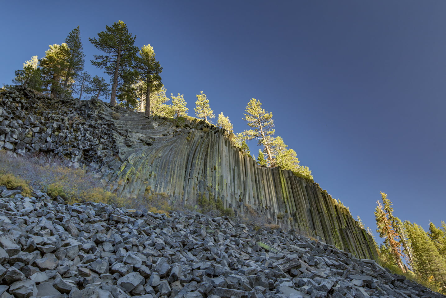
It was a chilly, fall morning when we set out on the trail. Twenty-two degrees Fahrenheit to be exact. Bundled up in our puffy, down jackets, the two of us headed south on the John Muir Trail (JMT) toward Devil’s Postpile. We skipped seeing the monument since we visited it the year before when we hiked to Rainbow Falls, but if you have never made the trip, it is worth the half-mile detour to the base of the rock formation.
You can mull-over your decision for the first half-mile on the trail. At the junction head right toward Minaret Falls (or continue straight to see Devil’s Postpile, then backtrack to this point), and take the bridge across the San Joaquin River. After crossing the river you’ll take another right on the Pacific Crest Trail (PCT)/JMT and steadily climb through pine trees along the river. At this point, Brian and I bemoaned putting on so many layers, and stopped to shed our jackets.
Stay to the left on the JMT when it branches off from the PCT, and continue your climb — unless you feel like making the detour to Minaret Falls. We didn’t because it would have been an extra mile or so tacked-on to an already long hike, and our research showed us that it was just a small cascade. This ended up being a good decision because we saw what was a much more impressive falls further up the trail.
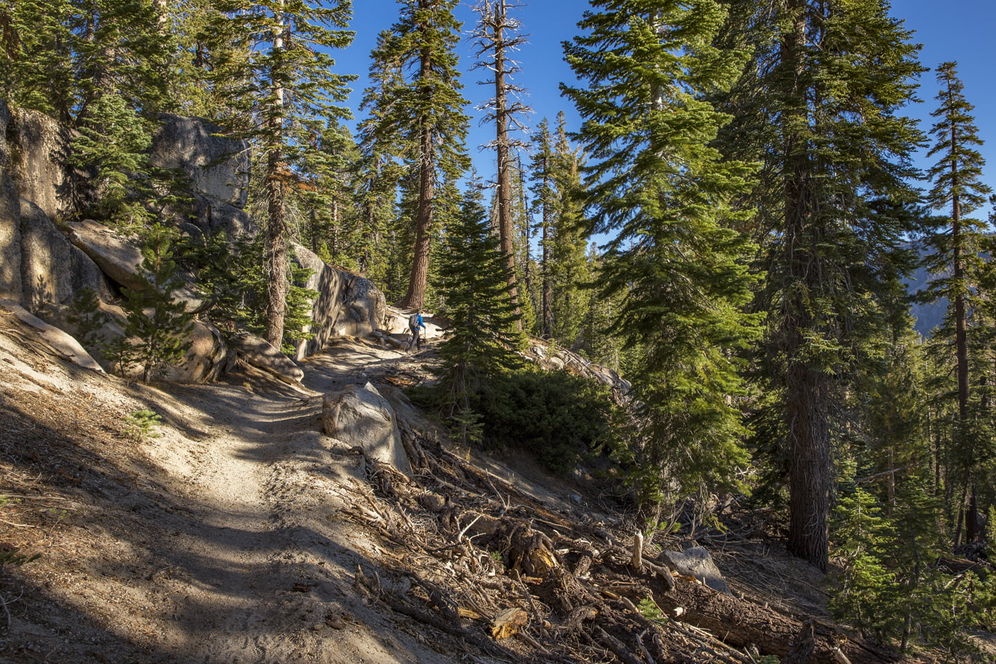
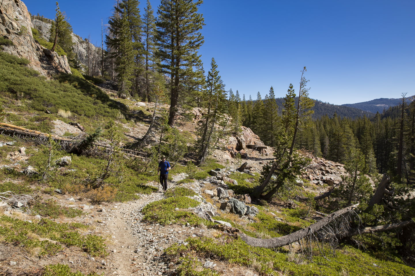
The JMT continues up through the forest along Minaret Creek. At 1.6 miles veer right toward Johnston Lake. Through this section there are a few false trails that branch off, and staying to the right each time kept us on the correct path.
There was one stream crossing through this section, and luckily since it was Fall, the water level was low and we easily hopped across Minaret Creek via a few rocks. I would imagine in summer it might be a bit more of an ordeal, especially in the early months, or after a season of heavy snowfall.

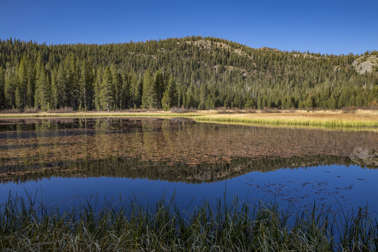
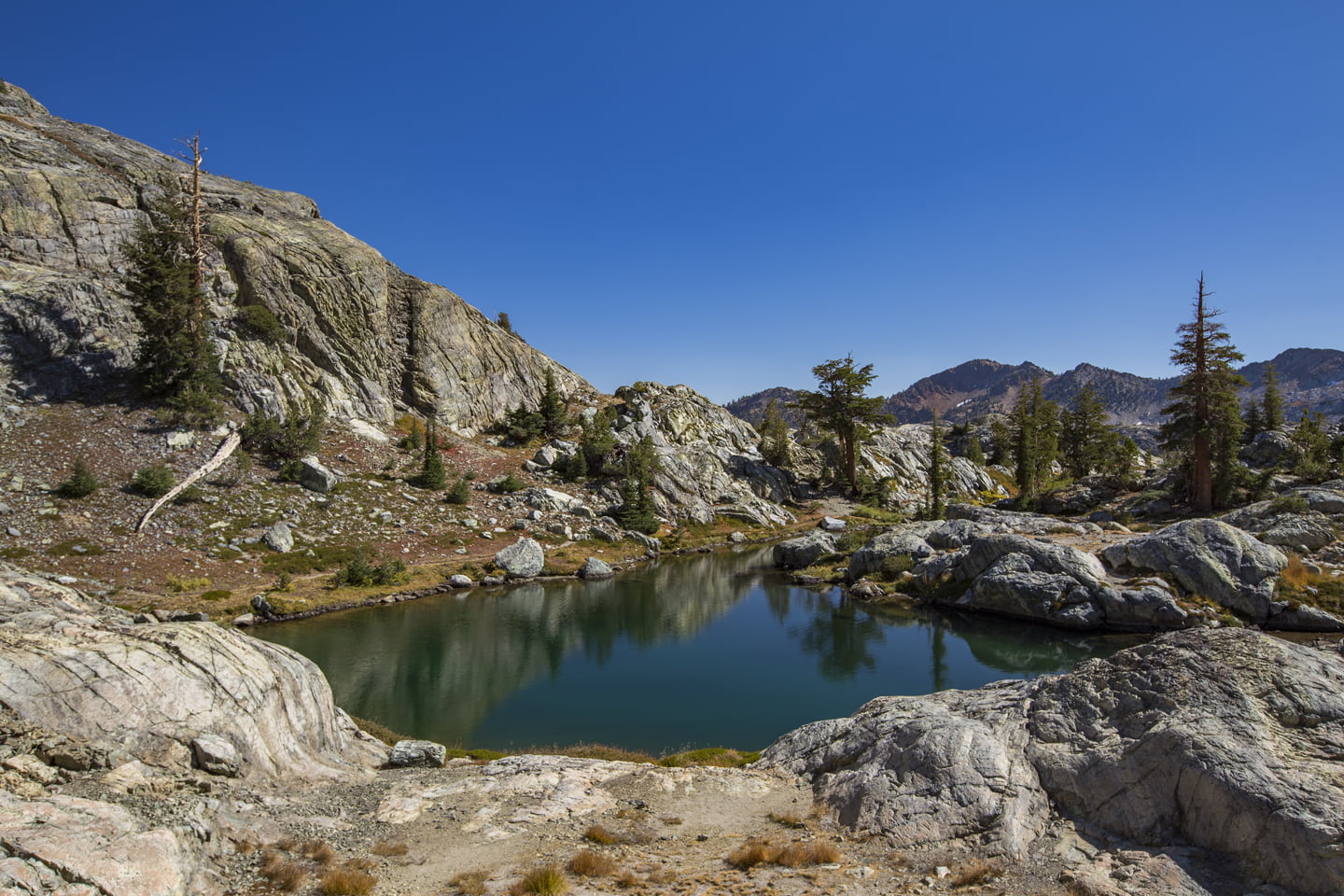
At the 2.28 mile mark, Brian and I arrived at Johnston Lake. We took a short footpath to the lake shore and while the lake was not especially scenic, we enjoyed photographing some reflections before hitting the trail again.
Just past the lake, there will be another fork where you will stay to the left: saying goodbye to the JMT and hello to the Minaret Lake Trail. This path continues winding through the forest, but some of the scenery gets more interesting as Minaret Creek cascades through a shallow, rocky canyon. We stopped for a snack here and a listened to the rush of water over the rocks as we rested.
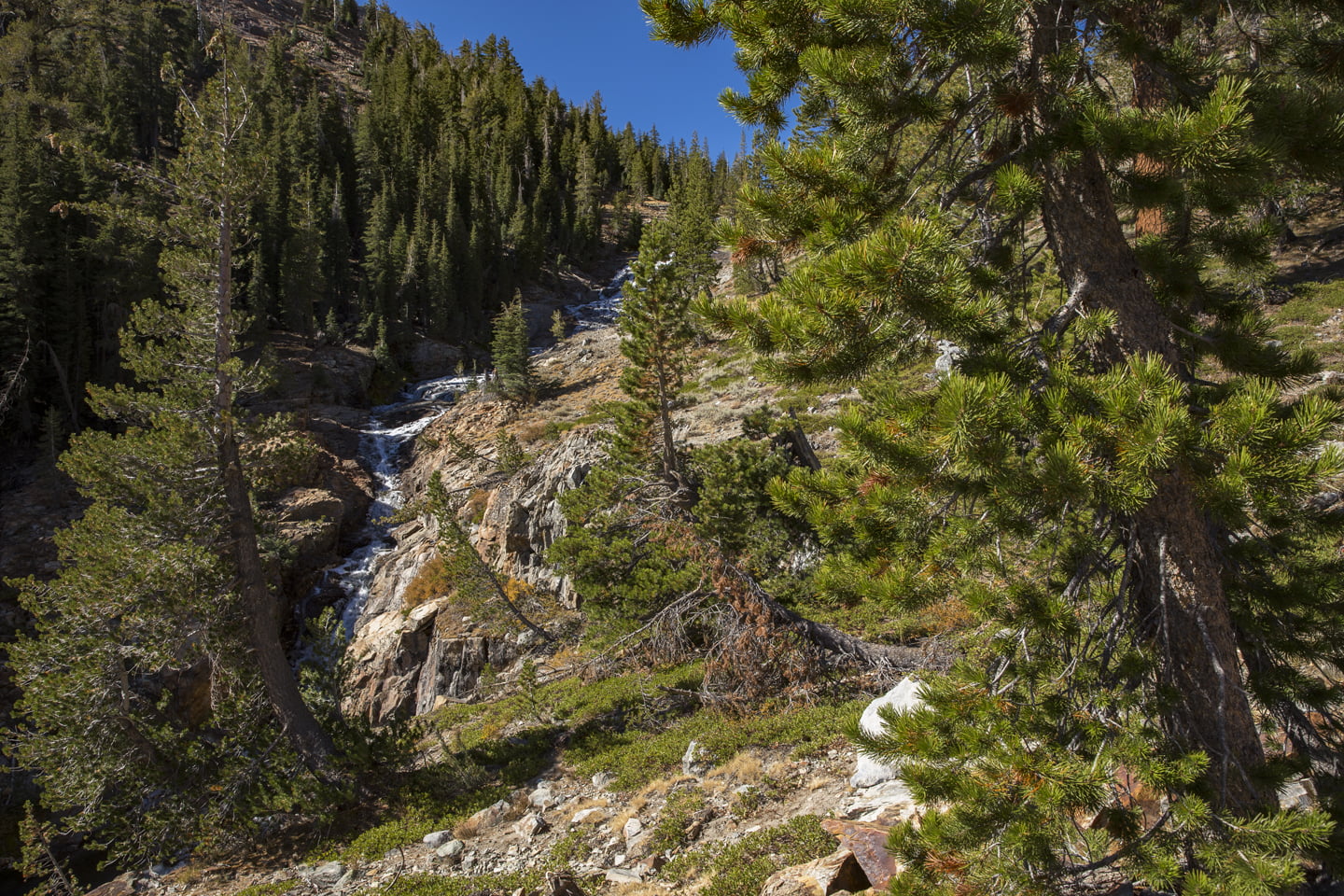
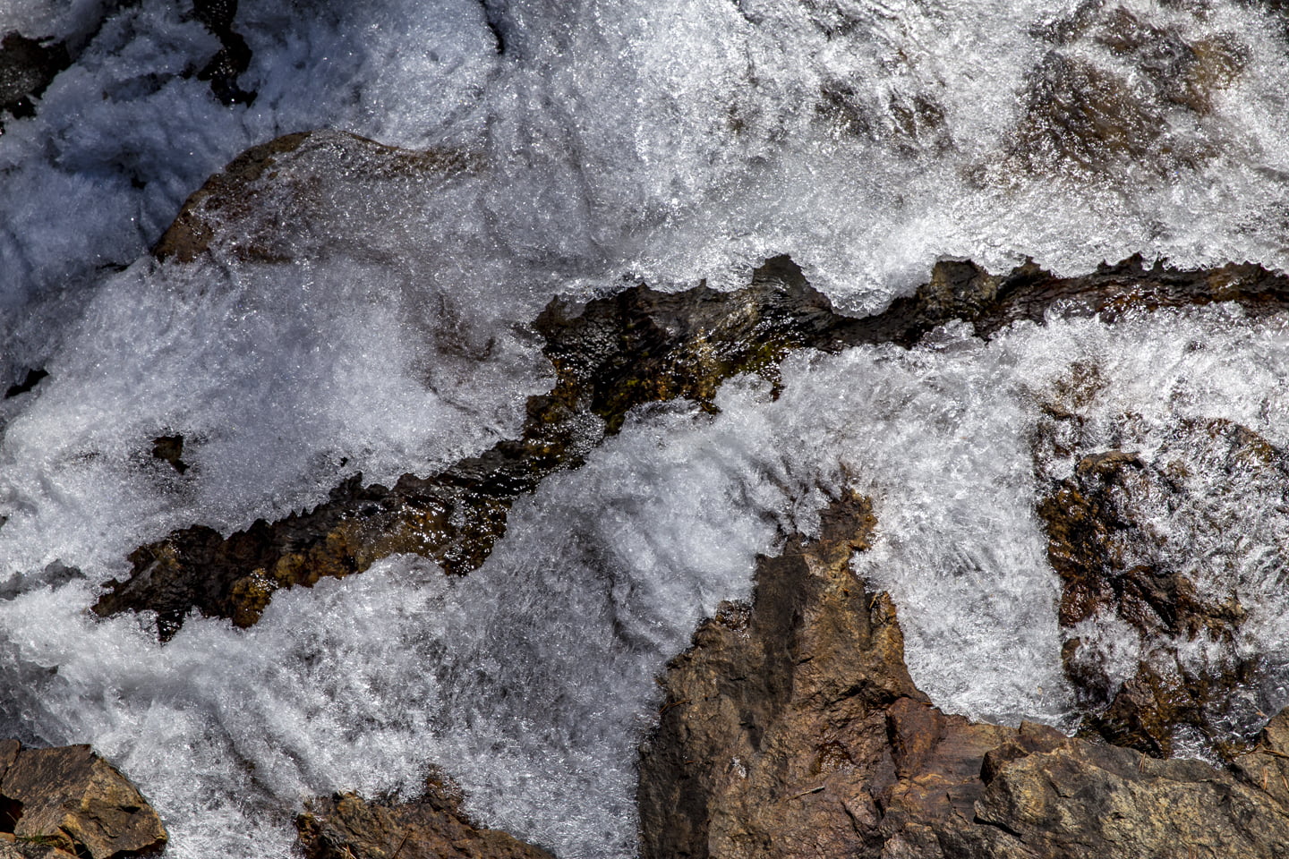
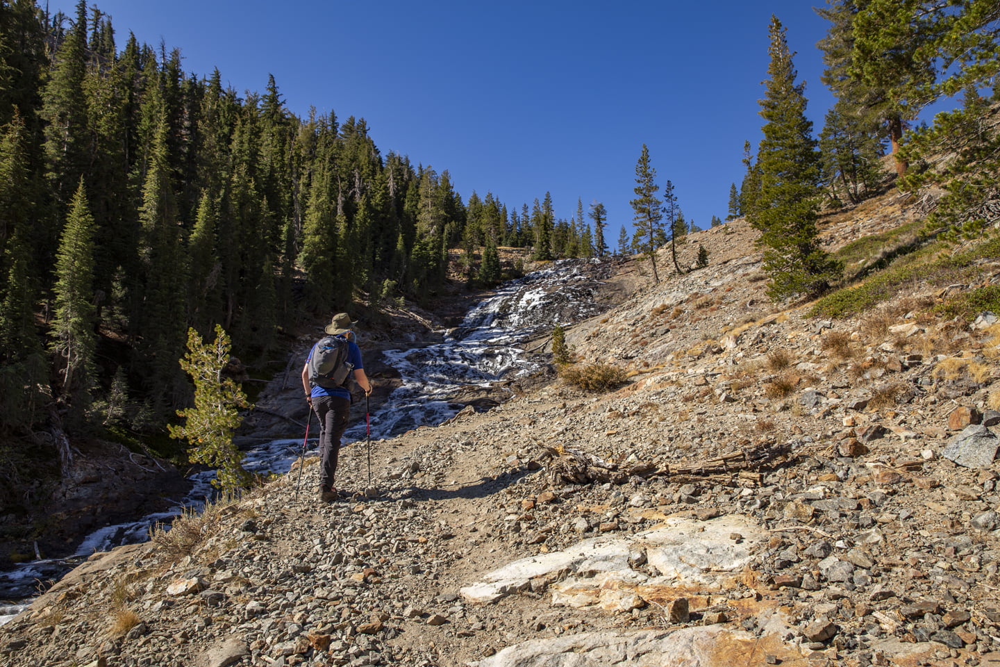
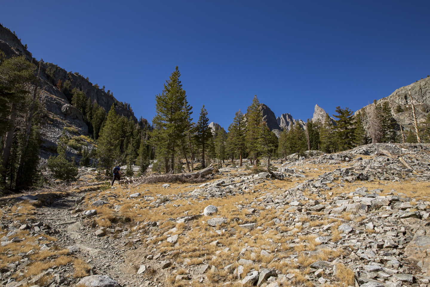
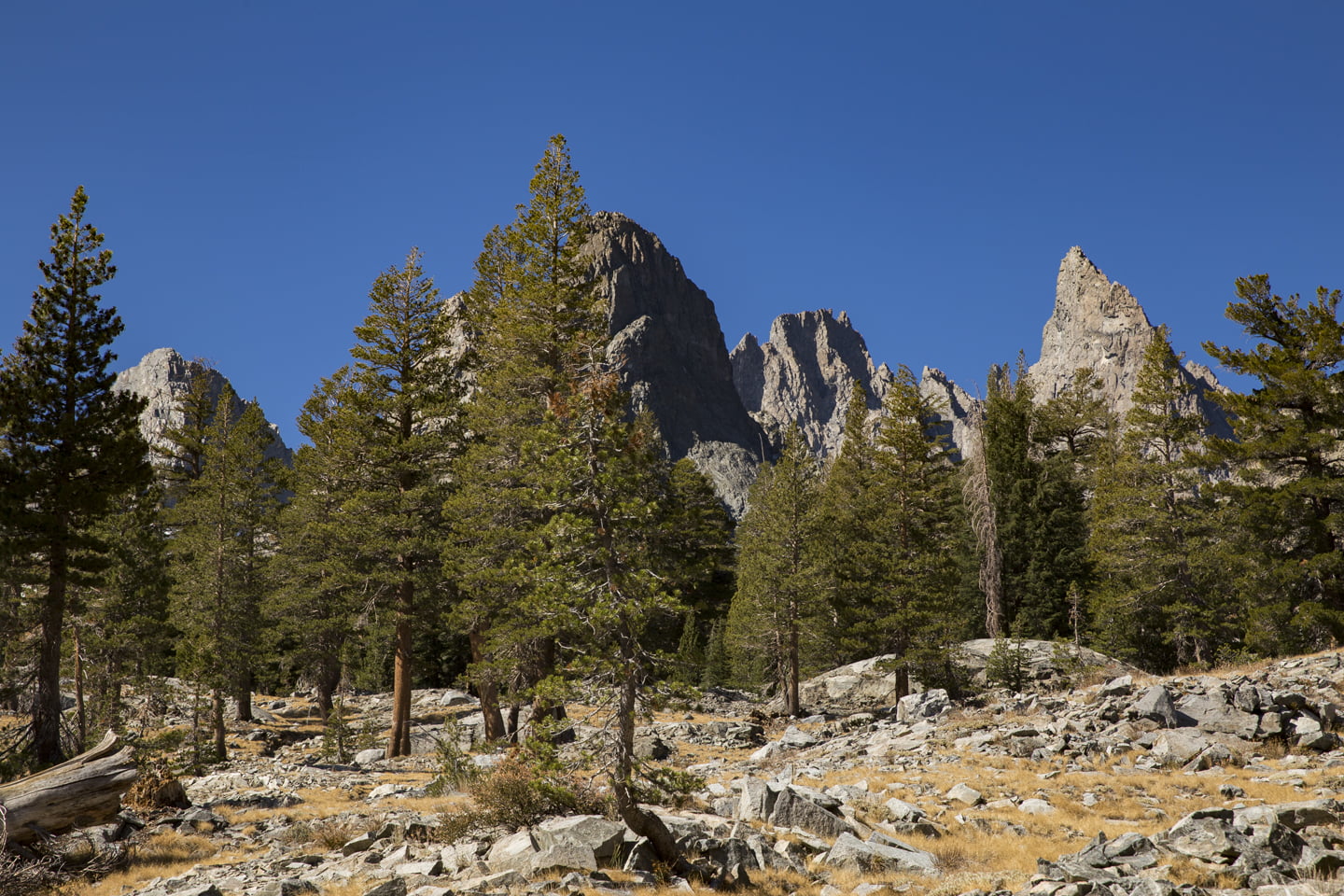
The views open up for a bit just after four miles, and you can begin to see the minaret spires in the distance. We were distracted by a partially frozen waterfall 4.35 miles in, and just past this marker you will begin to climb up more through a few switchbacks.
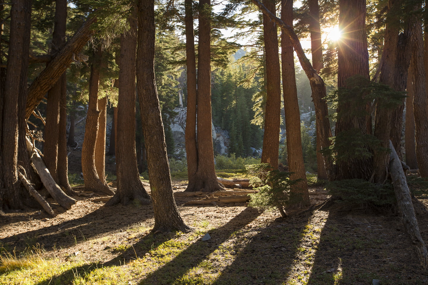
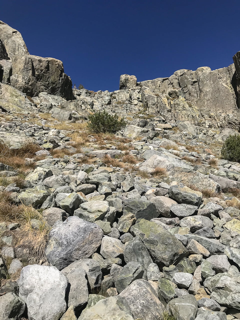
Back in the forest, take the first log to the left to cross the creek again. From this point, you’ll be alternating between forest and rocky landscapes for about three miles.

After several series of switchbacks, coupled with a few false promises of arrival, you’ll get to the lake shore at mile 7.4.
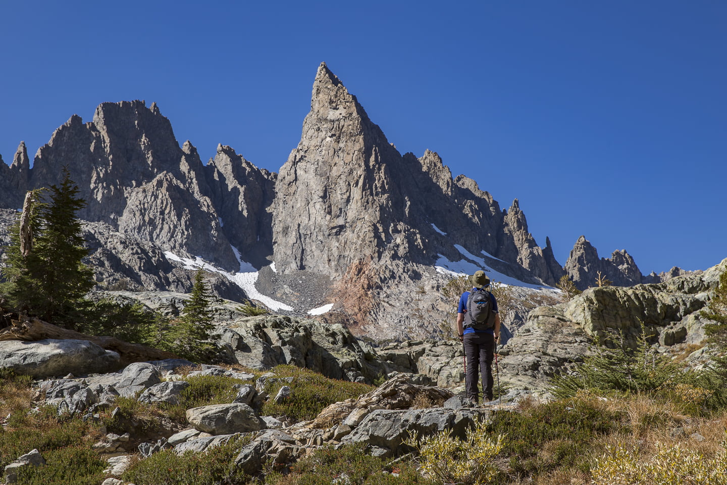
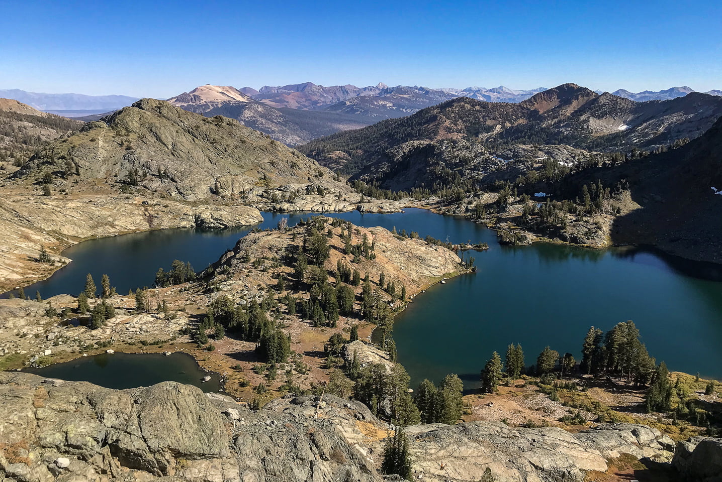
Brian and I were both in awe of the grandeur of Minaret Lake. It was much larger than we imagined, and of course the craggy spires that surround the sapphire blue waters are breathtaking. In the summer, it would be splendid to go swimming here, but with the cold temperatures dipping my feet in would have to do.
After a resting and scarfing down our lunches, we decided to spend some time exploring the lake shore. While we were both pretty exhausted at this point, it was worth mustering up the energy for exploration since the lake is irregularly shaped with lots of rocky coves. It would be a shame to come so far and only see one part of the basin.

We headed counter-clock wise, and I ended up soaking in the sunlight on a little peninsula that is in the middle of the lake while Brian tried to see if he could make it up to Cecil Lake. The trail between the two lakes in not marked, and is quite a scramble.
Brian ended up going off the route and giving up on the adventure since we still had to hike back down and it was getting late in the day. He managed to snap a few photos of Minaret Lake from above though, and considered it all worth it for the views. On an overnight trip, it would definitely be worth it to try again.
After reuniting back by the lake shore, it was time to race the sun and head back to the car. We lost, having to finish the last two miles in the dark, but we were prepared with headlamps. After a long day on the trail, we stumbled into Mammoth Brewing Company for some well-deserved burgers and beers.
Minaret Lake was an ambitious day hike, but it was a wonderful adventure that we are looking forward to repeating as a backpacking trip. I am already daydreaming about photographing the morning alpenglow on the spires, and I know Brian is anxious to get to Cecil Lake.
Have you ever been to Minaret Lake? Let us know in the comments!
More Eastern Sierra and Mammoth Lakes Hikes:
Hiking the Little Lakes Valley
Shop our favorite gear for this adventure:


SAVE THIS POST FOR LATER!

Nice pics and description. Your write up motivates me to go back in fall. The view of the lake from above is specially stunning, i didn’t have the energy or the time (to make the last shuttle) to explore towards lake Cecile, which is the base of the climb up clyde minaret — next time!
I thought the altitude gain is closer to 2,300 since the lake is at 9,800ish.
Thanks for the feedback, Ranjeet. We want to return to the lake as well to explore more of the area! Brian’s climb up toward Cecile Lake is included in the elevation tracking from his Garmin, which is why is may be a bit more than other sources. Happy trails!