Cutthroat Pass Hike | Washington Larch Hikes
Cutthroat Pass Hike| Written by Brian Callender | Photography by Julie Boyd

Cutthroat Pass: Hike Details
Starting Elevation: 4,847 ft.
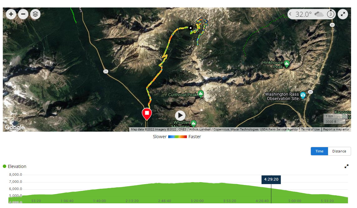
Distance: 10.5 miles (we tracked 12.5 with some additional walking around at the pass)
Elevation Gain: 2,444 ft.
Hike Type: Day-hike, out and back
Difficulty Level: Moderate-Hard
Road Access: NF-600 road is a short, dirt road with limited parking
Best time to Hike: Summer — Fall
Food Storage: No bear boxes are available. Please store your food properly.
Restrooms: Two pit toilets at the trailhead. Be sure to supply your own toilet paper if you visit between October and May as they are unmaintained by the NPS.
Cell Service: Limited
plinko. .
Crowd Factor: High
Permit: Northwest Forest or America the Beautiful Passes are required to park. No permits required for the hike
Date Hiked: 10/9/2021
An important distinction to note about this hike are that there are two ways to reach Cutthroat Pass. This write up is based on our experience hiking Cutthroat Pass via the Pacific Crest Trail. A second option is to hike via the Cutthroat Lake Trail which includes the namesake lake and a bit more elevation gain. We opted to choose the PCT route because it is a more gradual approach and always welcome any opportunity to hike along the PCT.
Getting to the Cutthroat Pass Trailhead
From Seattle, it’s a 3 hour drive north to reach the Cutthroat Pass trailhead. Head north on I-5 and then transfer over to WA-530, before picking up 20E towards Marblemount. Continue on the North Cascades Scenic Highway and turn left on NF-600 road, just across from the Rainy Pass trailhead.
Hiking Cutthroat Pass
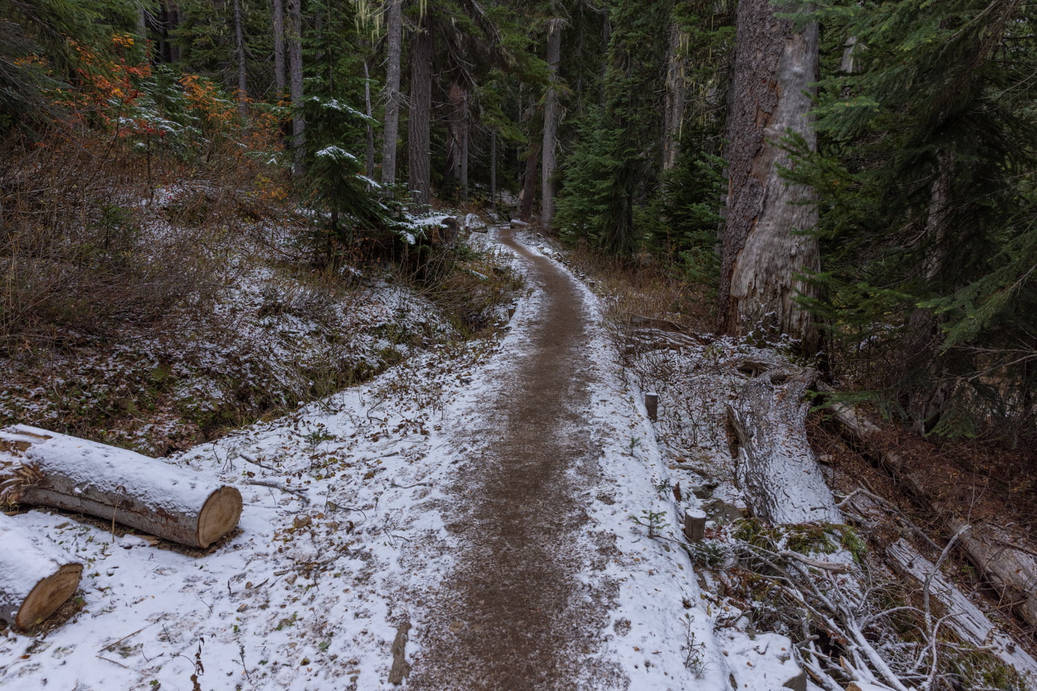
Early October in the North Cascades can most closely be associated with late fall, so we were eager to visit before winter moved in so that we could see the golden larch trees. Knowing that this would be a popular hike, we stayed in the nearby town of Mazama so that we could get an early start. We arrived at the trailhead at 7:30 a.m. and the parking lot was almost full.
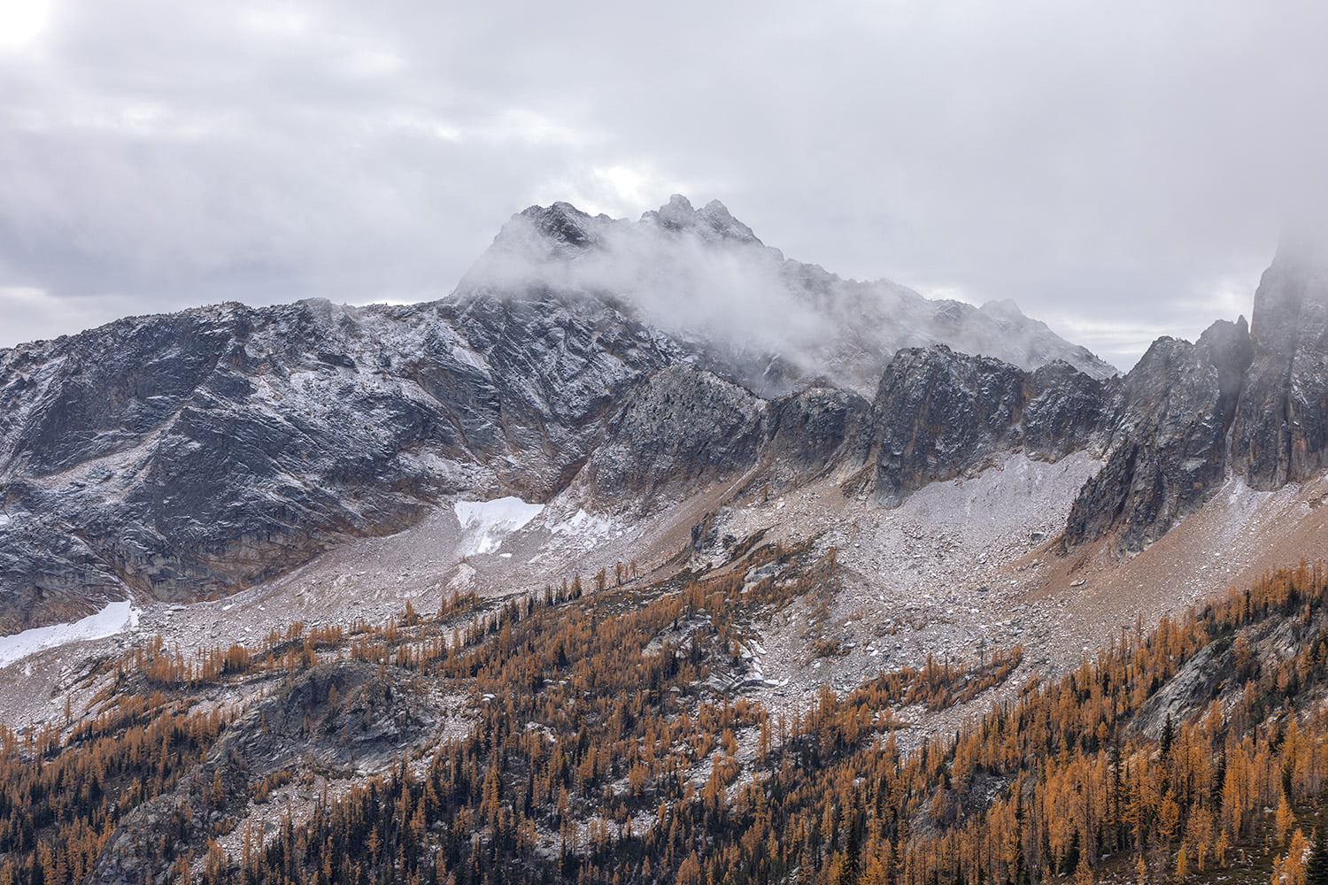
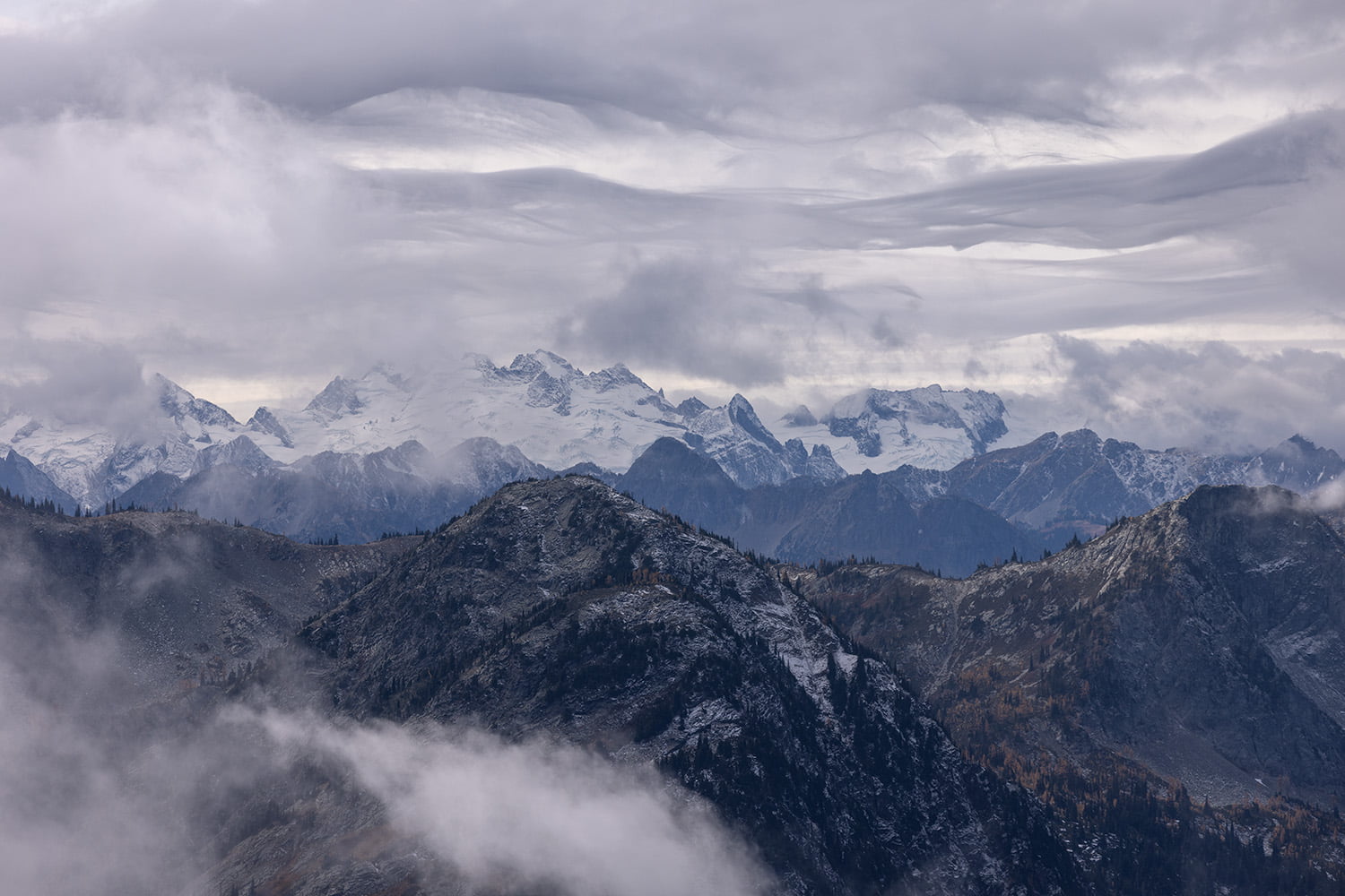
The trail begins with a grtadual ascent through a pine forest. At around 0.70 miles in you’ll come to a short creek crossing with plenty of large rocks to hop across and keep your feet dry. The trail comes out of the trees as you cross the mile mark to some nice views. After around a half mile of flat hiking, you’ll come to a second creek crossing and a third very quickly after. Once you pass this section of trail, you begin a gradual ascent. A short time past 2.5 miles, is the fourth creek crossing. Views here open up and are no doubt beautiful, but we were greeted by a thick layer of fog and clouds, as a light sprinkle of snow flakes fell.
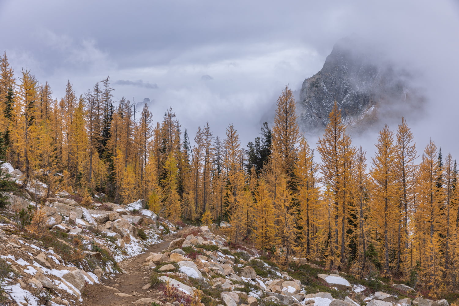

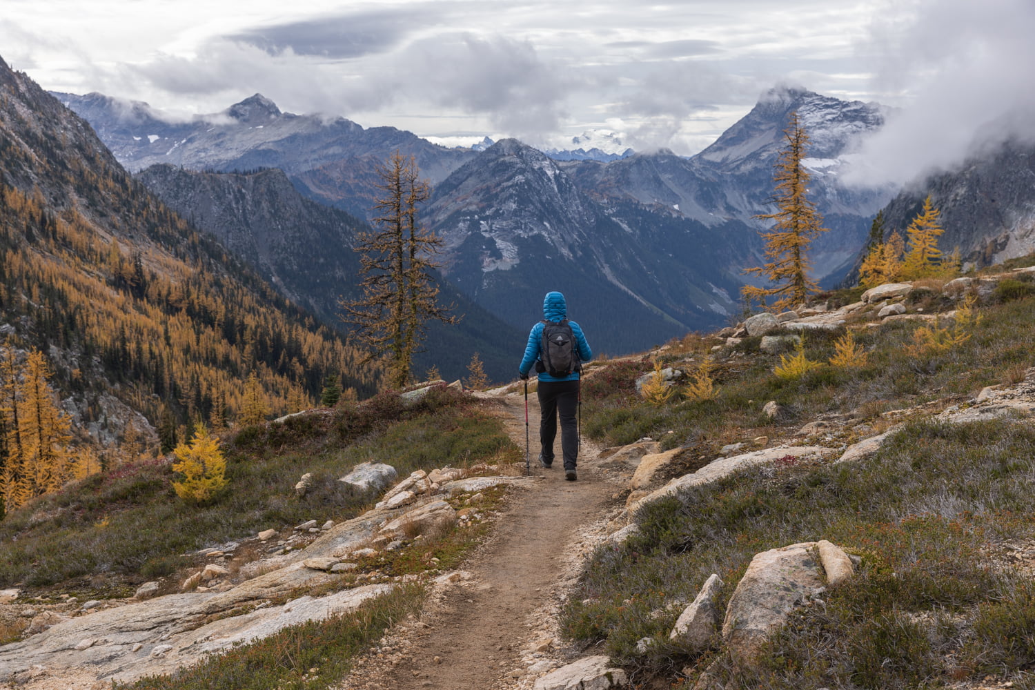
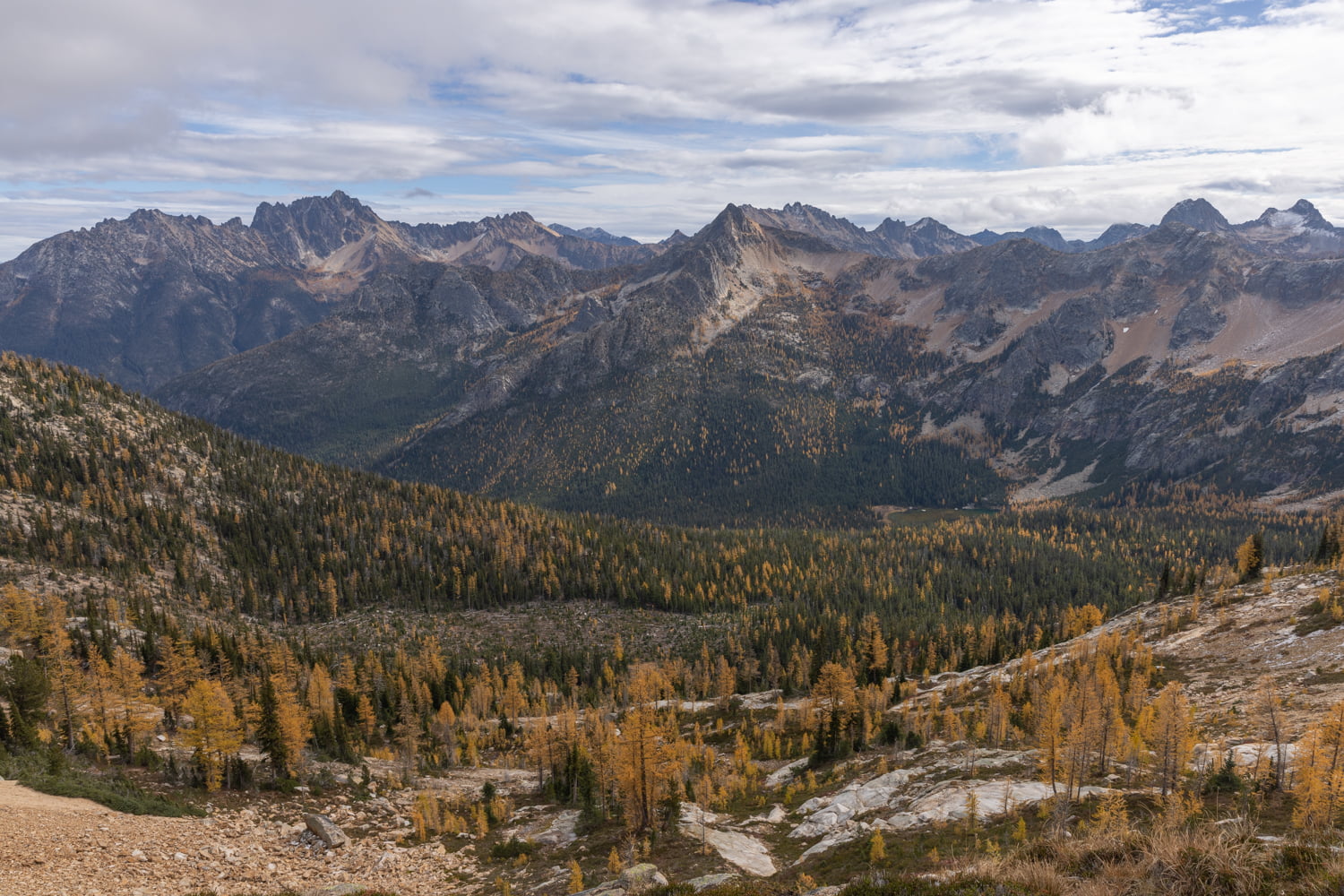
Passing three miles, we were excited to catch our first glimpse of where we were heading, a larch filled mountainside. At 3.6 miles, the larches came into focus in all their yellow glory. It’s hard to imagine a more beautiful place for fall colors. From this point on, we were slow-going as we stopped a ton for photos and to really soak in the scenery.
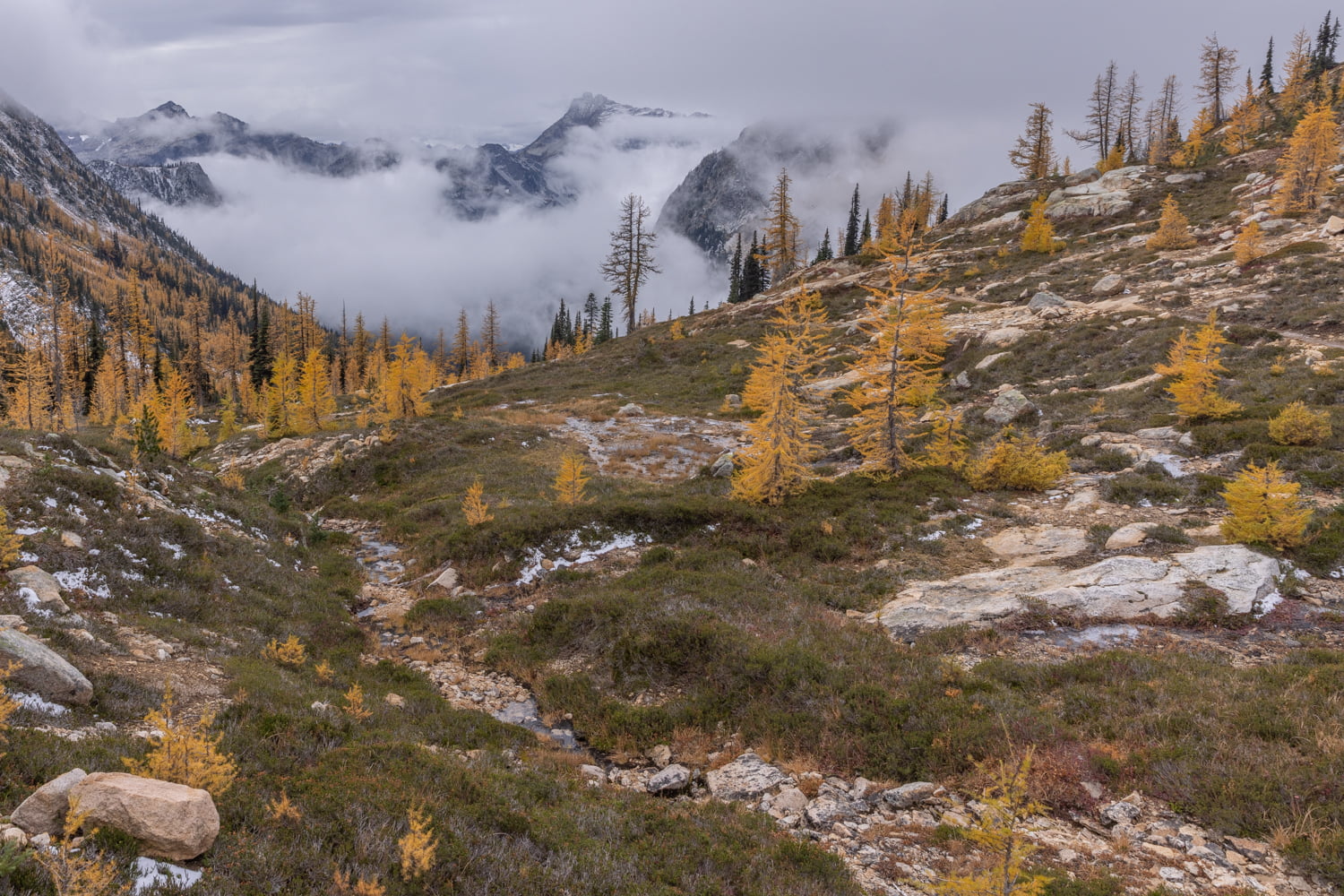

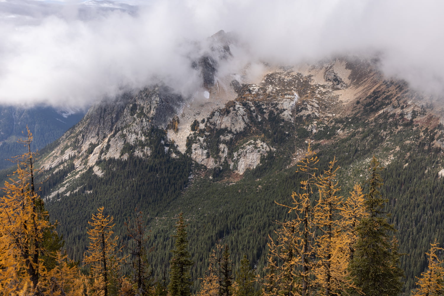
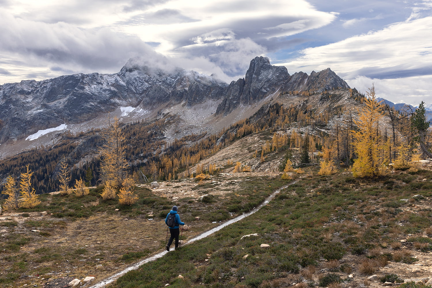
We reached Cutthroat Pass at 5.25 miles and just under 2,000 feet of elevation gain (1,973). Even though there were many other hikers here, we never felt cramped, as there is plenty of space to spread out and relax at the top of the pass.
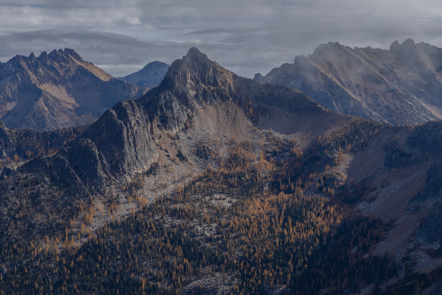


After taking in the views, we found a few rocks to sit on and enjoy our lunch. From the pass you can see where the PCT continues on, as well as where the Cutthroat Lake trail switchbacks up and joins the PCT in the distance. We spent quit a bit of time at the top, there was a trail leading to the right along a ridgeline that we explored, and then it was time to descend.
Final Thoughts on Hiking Cutthroat Pass
If you’re looking for a hike to see the larches, this is one of the best bets in the North Cascades and Washington. The trail is easy to reach and compared to the crowds across the street at Maple Pass, it makes for a much more enjoyable day.
MORE ADVENTURES FROM WASHINGTON
Hiking to the Chain Lakes Loop
Fall Roadtrip through Washington