Mount Watkins Hike | Yosemite National Park

Mount Watkins Hike | Written by Brian Callender | Photography by Julie Boyd

Mount Watkins Hike Details
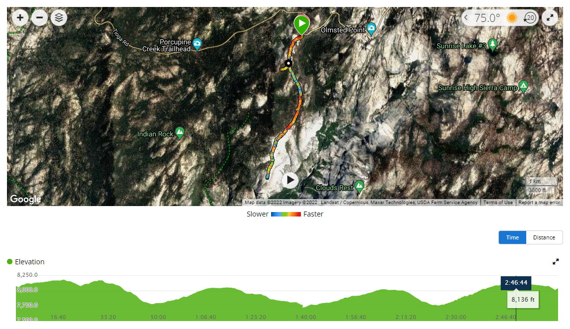
Starting Elevation: 8,049 ft.
Distance: 7 miles, round-trip (if you hike to the very end)
Elevation Gain: 1,240 ft.
Hike Type: Day-hike
Difficulty Level: Moderate
Food Storage: There are four bear boxes located at the trailhead
Restrooms: None. Closest option is at the Porcupine Creek trailhead
Cell Service: None at the trailhead but good at Mount Watkins
Crowd Factor: Low. We hiked out for sunset on a Friday and only ran into a small number of other hikers on trail. Other hikes in the area are more well-known and popular.
Permit: You need a National Park Pass to enter Yosemite but no permits are required for day-hiking this trail.
Parking: There is parking for between 5-8 vehicles and additional parking across the street.
Date Hiked: Friday, September 10, 2021
2022 Summer Entry Reservations
If you plan on entering the park during peak hours (6:00 a.m. — 4:00 p.m.) this summer (May 20 — September 30, 2022), you will need to book an entry reservation in advance through Recreation.gov. For more information, please visit the National Park Website here.
Getting to the Mount Watkins Trailhead
The hike to Mount Watkins begins just past the Porcupine Creek Trail Head and before you reach Olmstead Point. It’s accessible off Tioga Highway (120) and because the road is only open seasonally, it’s important to verify conditions with the National Park Service before attempting this hike.
From the South Bay Area, the drive takes about four hours and covers slightly over 200 miles.
If you’re coming from the Orange County/Los Angeles area, the drive is between 5.5 to 6.5 hours and just under 400 miles.
Hiking Mount Watkins
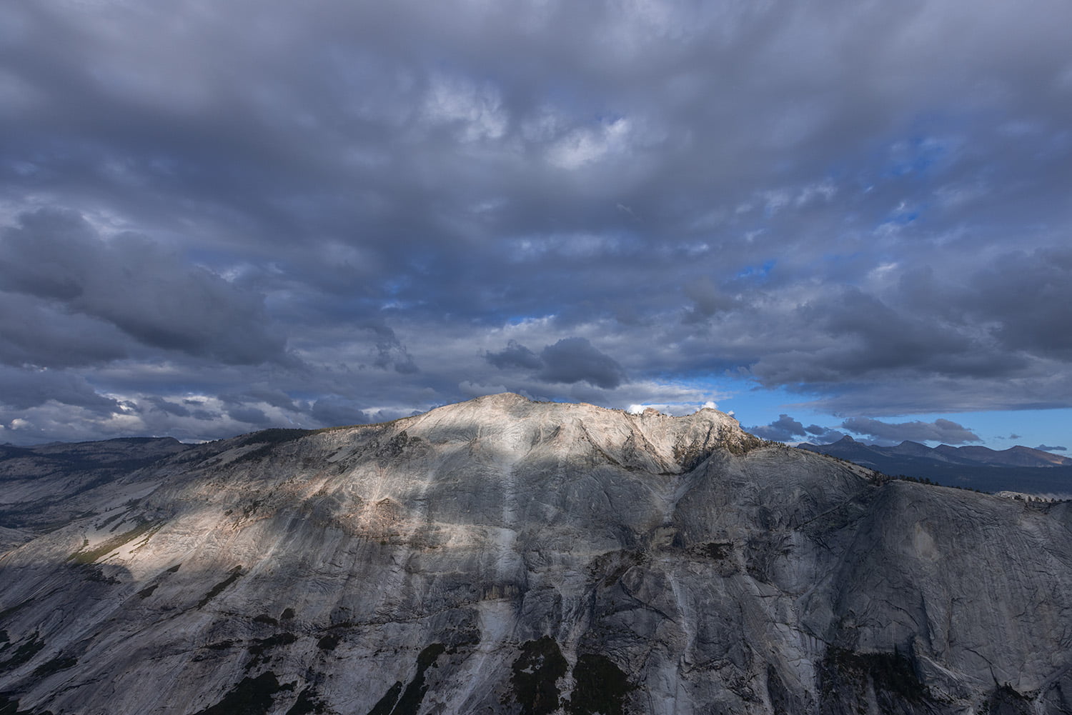
One of the great things about Yosemite is the different hikes you can take which provide varying perspectives of Half Dome, the park’s crown jewel. Some of our favorite hikes in the park to date include Cloud’s Rest, North Dome and the Four Mile Trail to Glacier Point which all offer spectacular views of the granite monolith. If you’re looking for an underrated option, be sure to add Mount Watkins to your list which offers another up-close vantage point and some of our favorite views to date.
Please note that the trail is not maintained, so we highly recommend having some hiking and navigation experience if you are planning on doing this hike. Bringing a GPS device or downloading an offline map from an app such as All Trails is also recommended. We did the later and definitely found it useful in a few spots where the trail was unclear.
To begin the Mount Watkins hike, walk past the gate and stay to the right where the trail picks up. After a brief incline, you’ll be walking on a sandy section of trail among an open mix of trees. On your left (south), you can see Clouds Rest for most of the early part of the hike. Once you pass a large boulder on your right, you’ll stay to the left instead of heading straight ahead into the trees. We overlooked the turnoff and went a short distance out of our way before checking our map and backtracking. Similar to hiking North Dome, the trail includes most of its descent early on, meaning you’ll cover a good portion of your elevation gain on the hike out.
You’ll reach an unmarked junction at 1.75 miles, but continue straight ahead here. As you approach 2 miles, the trail switches from flat to a slight uphill. We always take these sections slow as we’re usually starting our day off at low elevation and the transition to 8,000 feet hits the lungs pretty quickly.
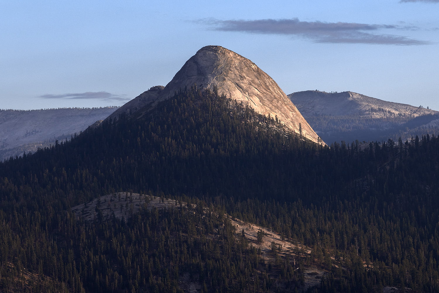
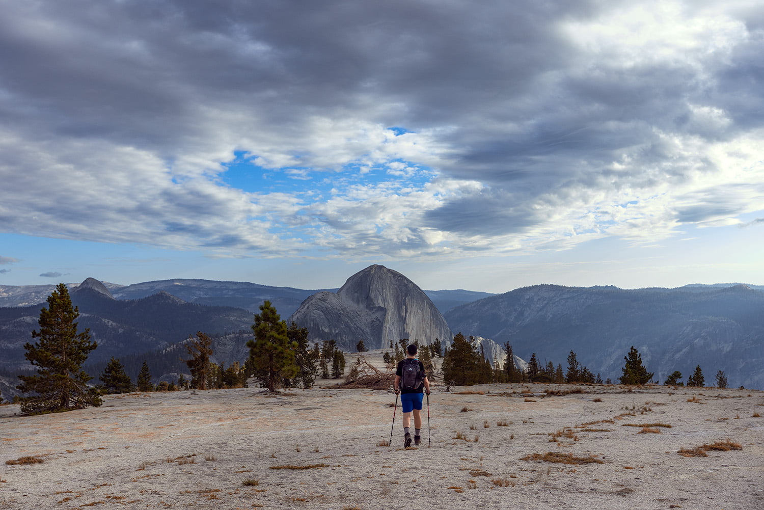
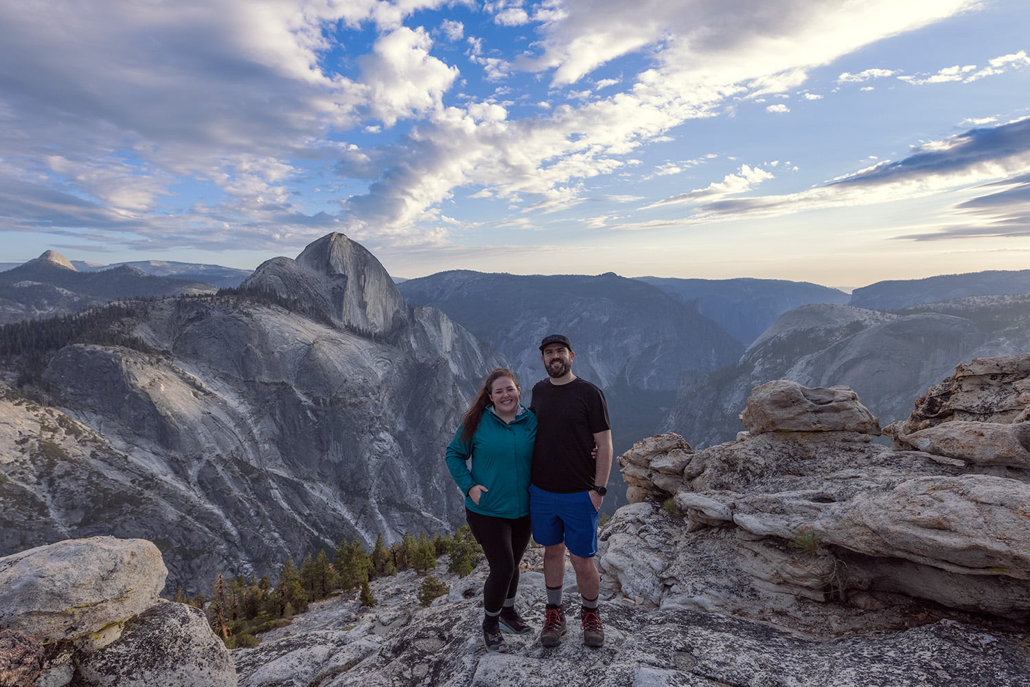
The trail opens up around the 2.5 mile mark. Here you’ll have sweeping views of Clouds Rest and eventually your first glimpse of Half Dome. At 2.7 miles, you’re officially standing on top of Mount Watkins. From here, you can continue as far as your heart desires. The further you go, the closer Half Dome will be and we opted to continue all the way to the end of the trail. Because we were there on a Friday late afternoon, there weren’t many other hikers out. Furthermore, those we did see didn’t go as far along the trail as we did, so we ended up having the place to ourselves.
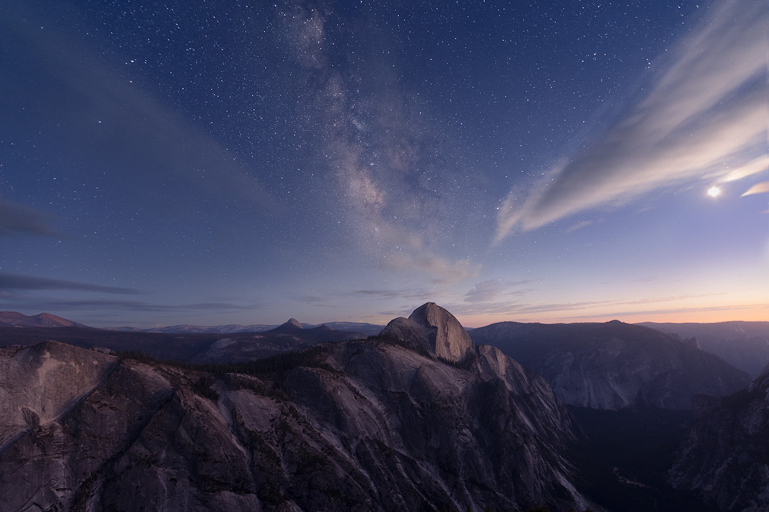
We brought a backpacking meal with us and set up for dinner while Julie got ready for sunset photography. We often joke about our track record of less than stellar sunsets while out hiking, but we were treated to a beautiful sunset this day. Once the sun had gone down and we had enjoyed a warm meal, Julie spent some time shooting the Milky Way as it graced the Yosemite skyline.
Having received our fill of Yosemite wonder for the day, we packed up our things and made the return journey via headlamp to the car. The elevation gain while not especially challenging still caused us to take it slow as our bodies worked to adjust to thinner air. A short while later, we made it back to the car and said an always difficult goodbye to Yosemite. Until next time!
Final Thoughts on Hiking Mount Watkins
Mount Watkins is a lesser known hike off Tioga Road but that was certainly to our benefit. The views were incredible and the lack of crowds as you would find on some of the more popular hikes were sublime. From the perspective at the end of the trail it feels as though you can reach out and touch Half Dome which is something special. We loved this hike and were excited to cross it off our list and highly recommend it to anyone looking for a new adventure!
More Adventures from Yosemite
Hiking Sentinel Dome & Taft Point
Shop our favorite gear for this adventure:


SAVE THIS POST FOR LATER