
Backpacking Ediza Lake | Ansel Adams Wilderness

Backpacking Ediza Lake | Written by Brian Callender | Photography by Julie Boyd

Backpacking Ediza Lake: Hike Details
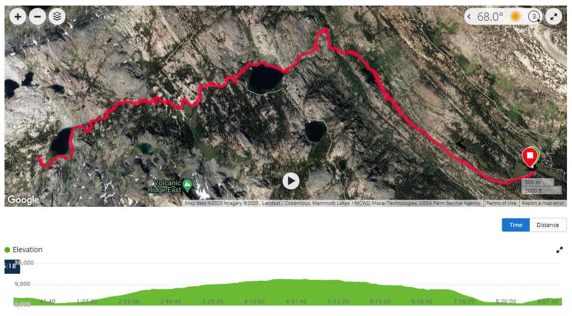
Starting Elevation: 8,100 ft.
Distance: 15.6 miles, roundtrip (where you set up camp will vary your mileage slightly)
Elevation Gain: 1,870 ft.
Hike Type: Overnight
Difficulty Level: Difficult
Food Storage: There are two bear boxes at the Agnew Meadows trailhead. The trailhead is very popular and was packed when we arrived. We had to cram our one bag of scented items into one of the already full bear boxes before starting our hike. Additionally, we brought our bear canister with us backpacking as bears are known to frequent the area and proper food storage is required.
Restrooms: Pit toilets are available at the trailhead. During our time there, they were some of the worst smelling toilets in recent memory.
Cell Service: Surprisingly, not bad at the trailhead. We had good cell service at the Agnew Meadows Campground where we stayed the night prior. An unexpected bonus prior to heading off the grid. There is no cell service at Ediza Lake.
Permit: Yes, for overnight trips. Permits are issued through Inyo National Forest and can be reserved online at www.recreation.gov
Date Hiked: September 4-5, 2020
Getting to the Agnew Meadows Trailhead
Located in the Mammoth Lakes region of the Eastern Sierra, the trailhead is nearly equal distance for those coming from either Northern or Southern California.
From Northern California:
Tioga Pass (Highway 120)
Coming from the Bay Area, the easiest way to reach the trailhead is to drive through Yosemite along the Tioga Pass. You will exit the park on the east side and continue south on Highway 395 towards Mammoth Lakes. Driving through the park does require paying an entrance fee, so it’s best if you already have a National Park Pass as we do.
For visitor’s in 2020, be sure to check out our post on Yosemite and their reservation process.
Sonora Pass (Highway 108)
An alternative for reaching Mammoth Lakes from the Bay Area is to take the Sonora Pass. This route allows you to bypass Yosemite and the entrance fees associated with traveling through the park. The Sonora Pass adds 40 miles and approximately 30-60 minutes to your drive as the road is windy and north of Yosemite.
From Southern California:
Arriving from Southern California, the route traveling north on Highway 395 is an incredibly scenic drive. After leaving Los Angeles and the subsequent valley, the drive up 395 parallels the Eastern Sierra as you make your way into Mammoth Lakes.
Once in Mammoth, take Minaret Road which will lead to the Devil’s Postpile/Reds Meadow area. The one-lane is narrow and winds down to the junction for Agnew Meadows off to the right.
Fee for Entry:
A fee is required to enter the Devil’s Postpile/Reds Meadow area with some exceptions. During the summer peak season, a shuttle is required during the hours of 7:00 a.m. to 7:00 p.m. to alleviate congestion in the area. For more information on current fees and shuttle schedules, be sure to check the National Park Service website.
Backpacking Ediza Lake

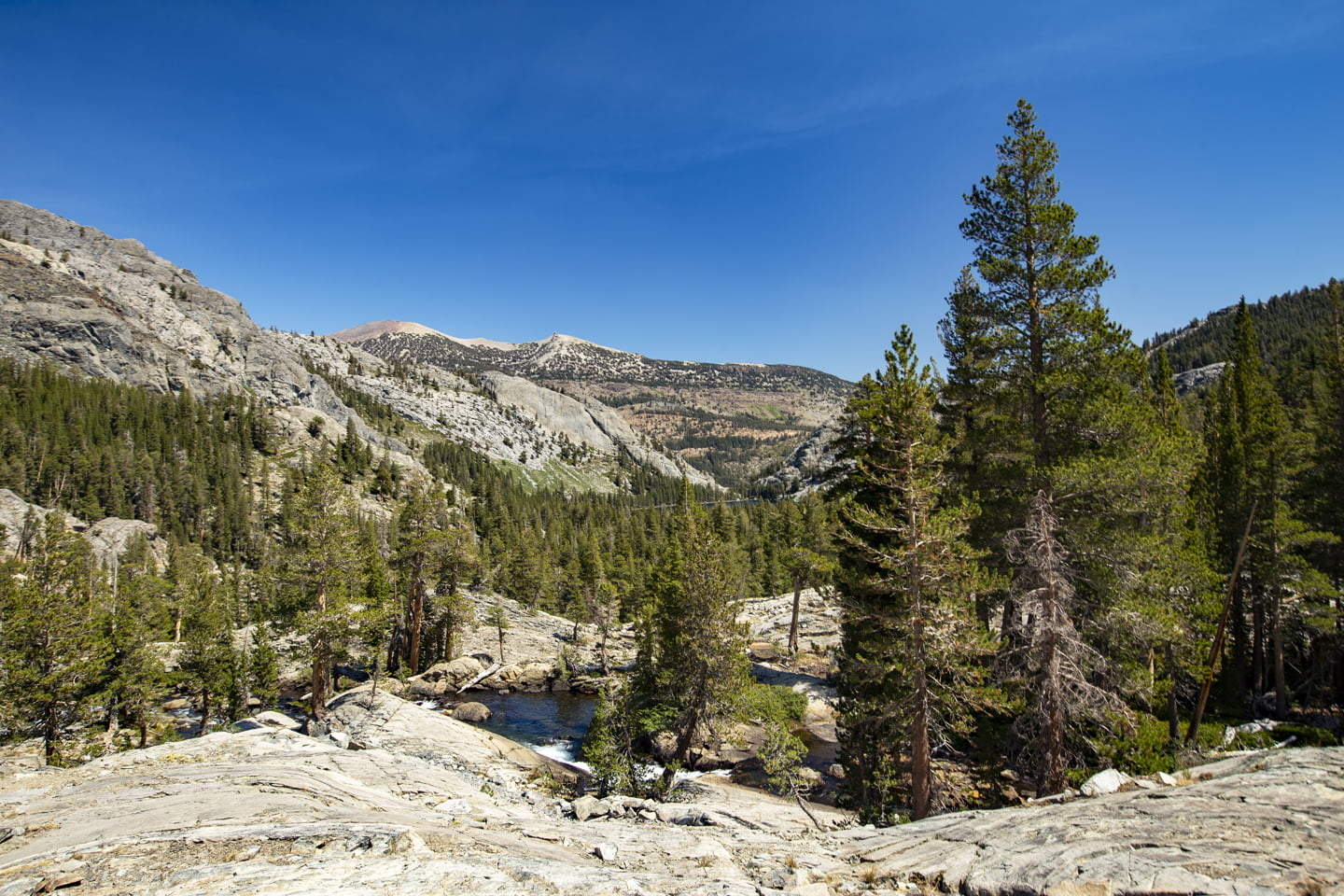
We started out by taking the PCT South/River/Shadow Lake trail which is just opposite the pit toilets and bear boxes. The first section of the hike is flat following along a soft, sandy path, but offers little shade.
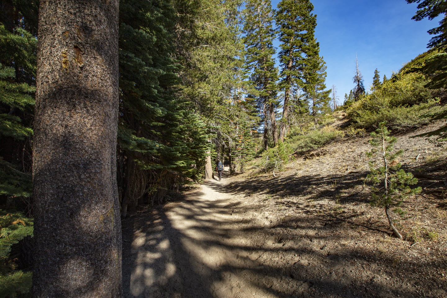
At 0.75 miles in, you’ll reach the boundary for the Ansel Adams Wilderness. Here the trail descends as you continue toward Shadow Lake. Soft sand gives way to a rockier terrain, following along a single track with a steep drop off to the left.
Once we reached 2 miles and just 70 feet of gain, we arrived at Olaine Lake which had a marshy feel to it, but nice morning reflections.

The junction for Shadow or Thousand Island Lakes comes at 2.4 miles into the hike and we veered left here towards Shadow Lake. A bridge crosses Shadow Creek at 2.6 miles before the trail begins to climb.
At 3.5 miles, your climb is rewarded with a cascading waterfall flowing down from Shadow Lake.
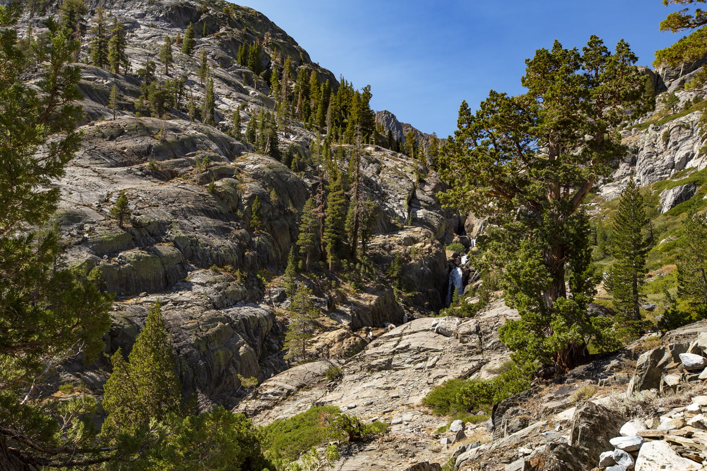
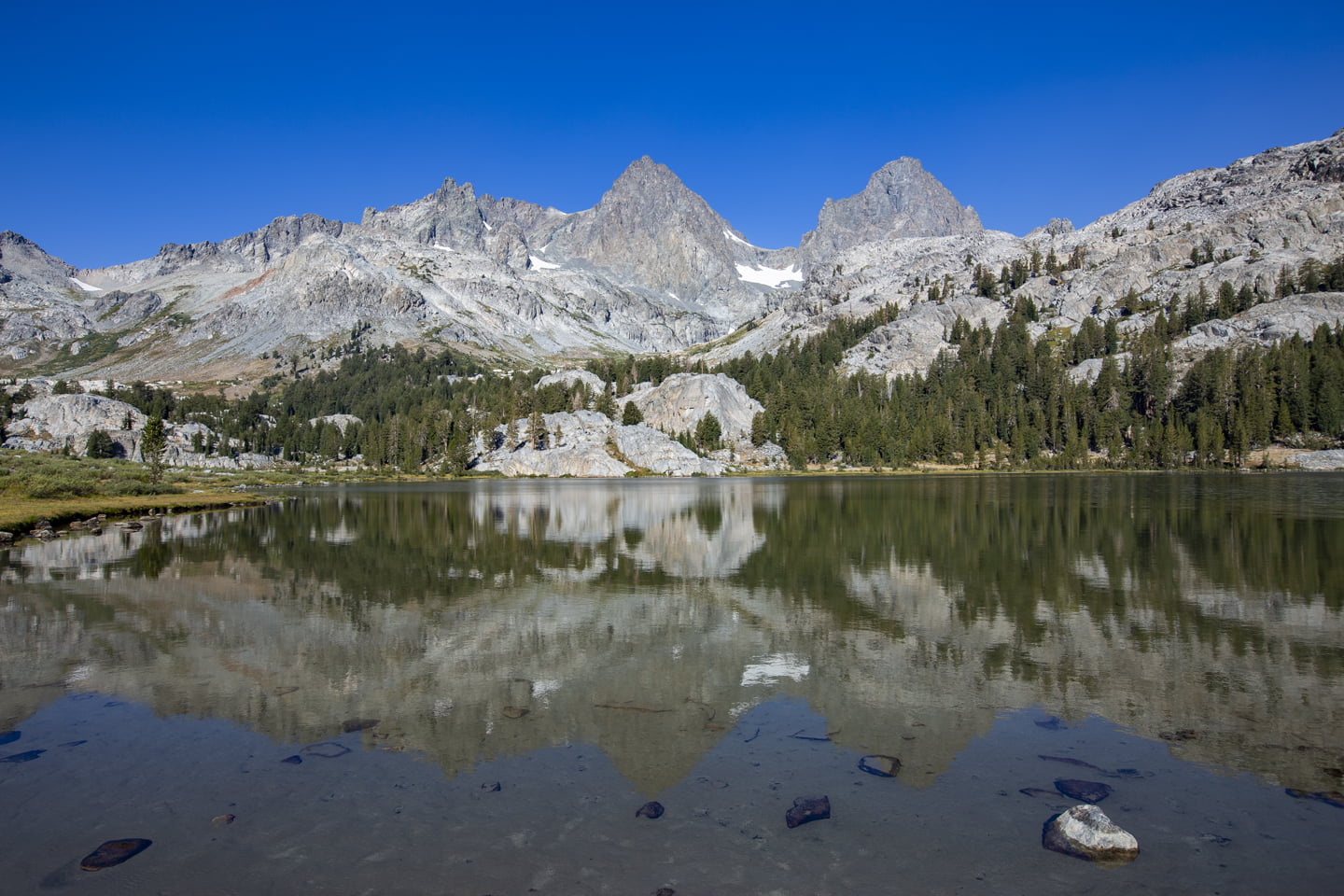
In another 0.2 miles and 700 total feet of gain you’ll reach Shadow Lake. We stopped here for a bit to take our heavy backpacks off and have a snack. Having seen photos of Shadow Lake in the past, Julie and I both agreed that they didn’t do the lake justice. The water on the lakeshore was crystal clear and had hints of turquoise as the water got deeper.
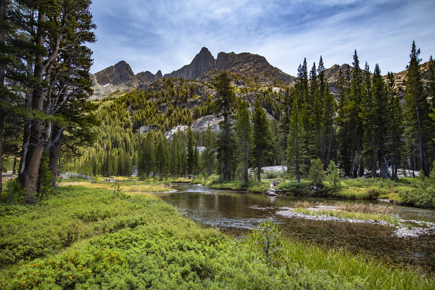
After a brief rest, we continued along the west side of Shadow Lake until we reached the junction for the John Muir Trail (JMT). Here you will continue towards Ediza Lake, which is to the right.
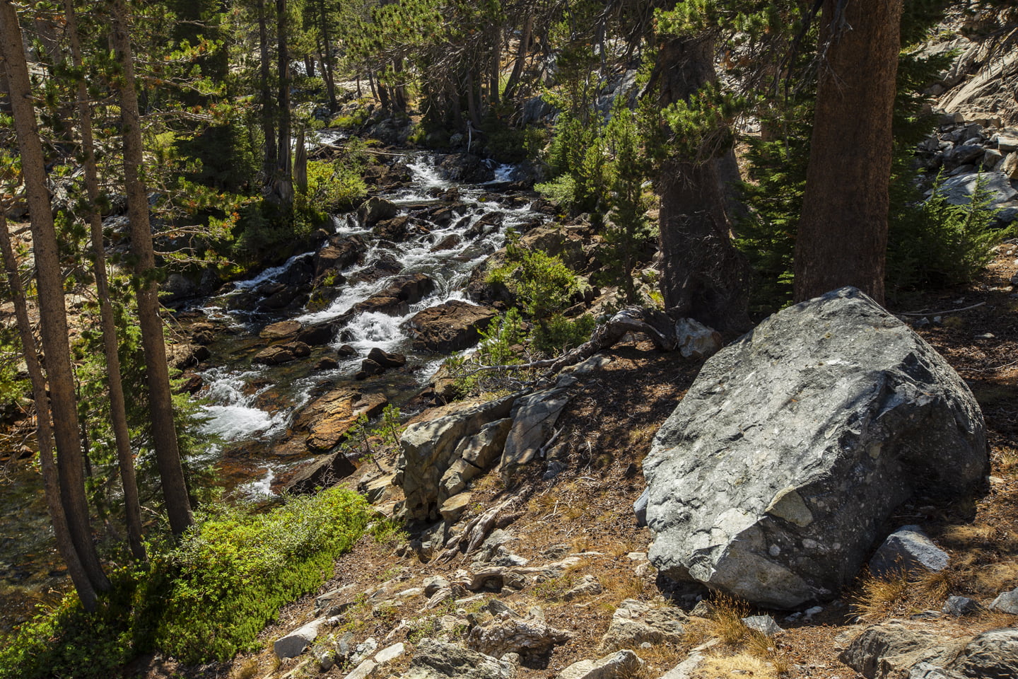
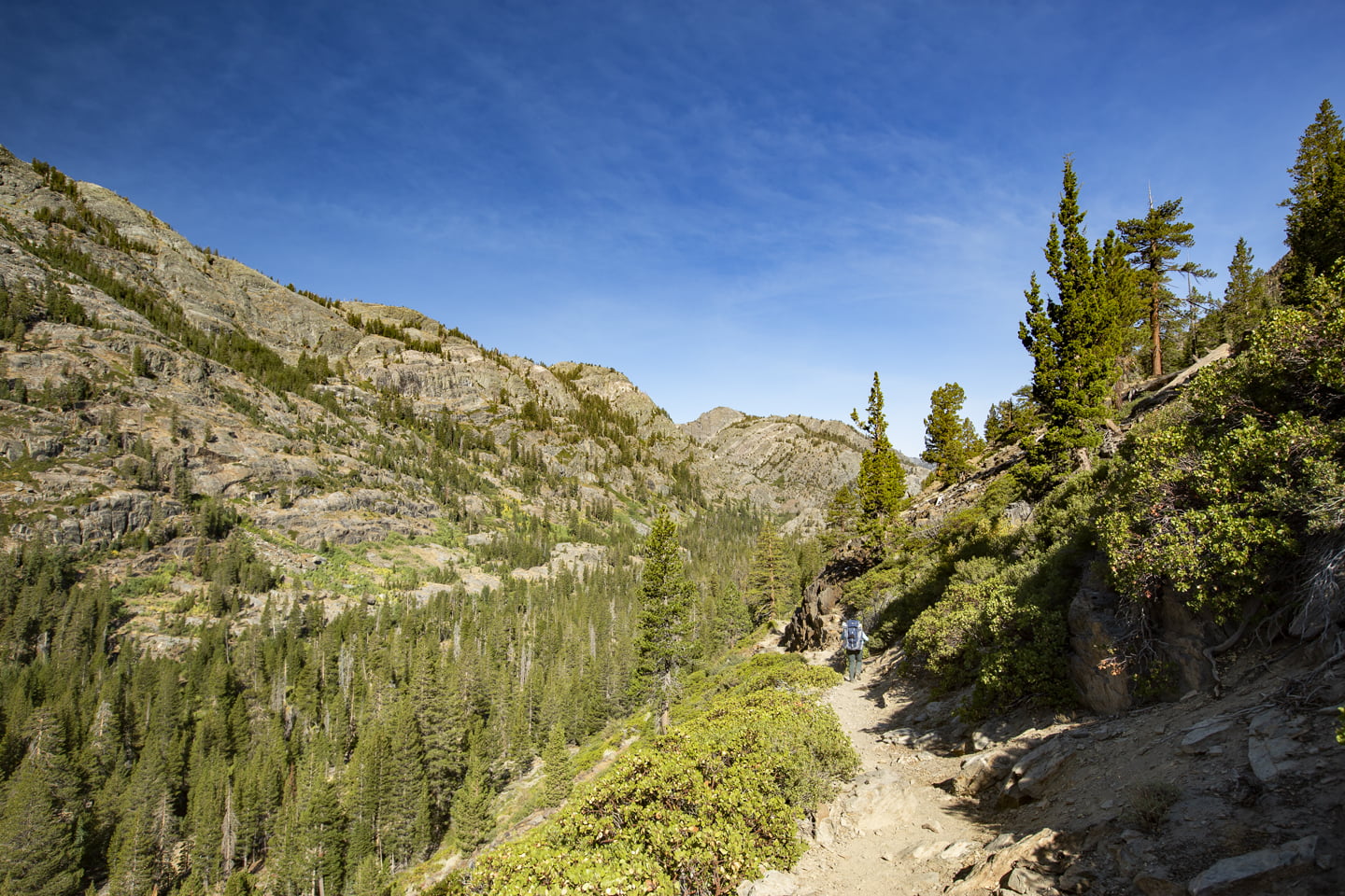
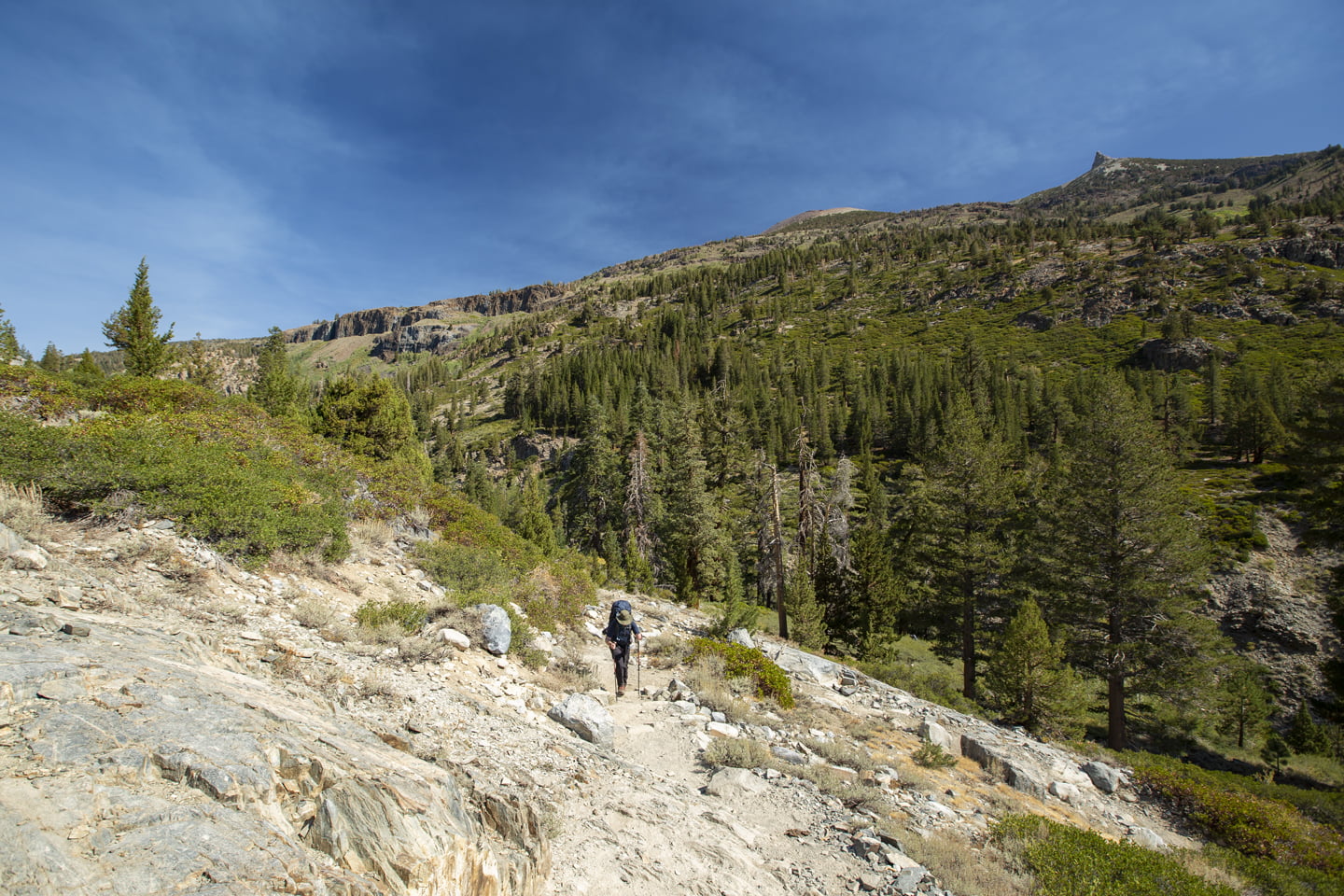
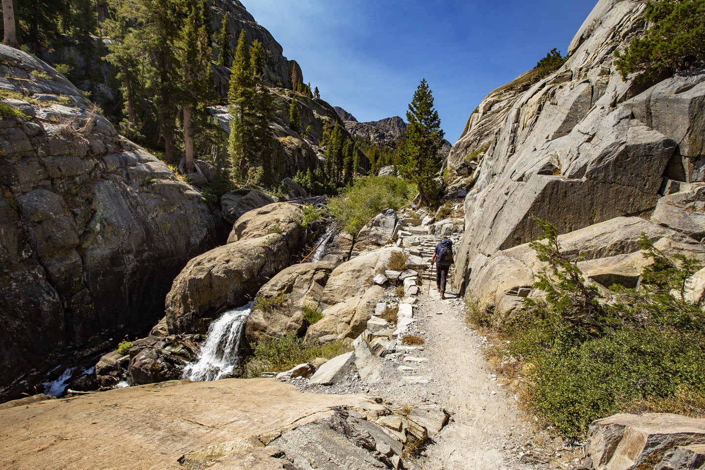
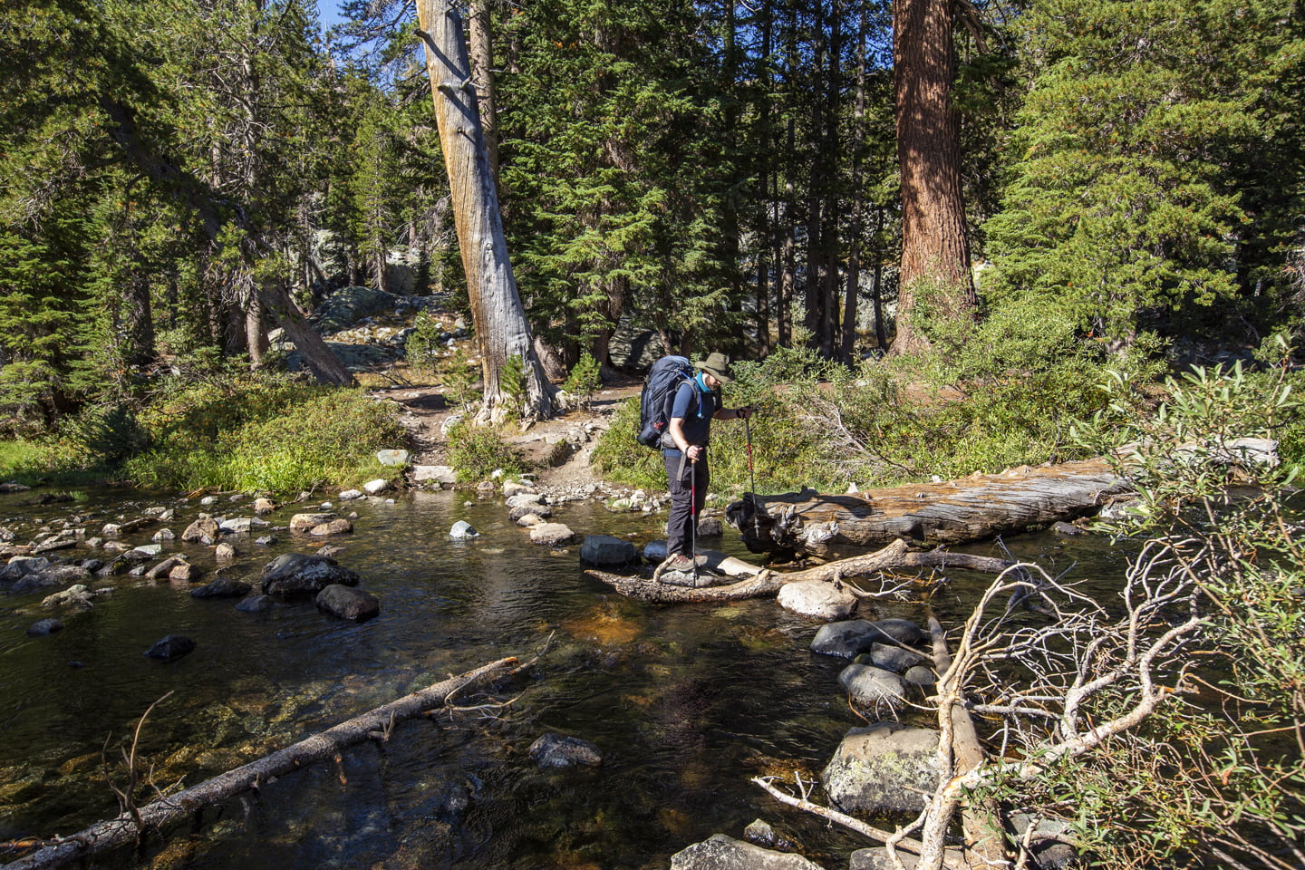
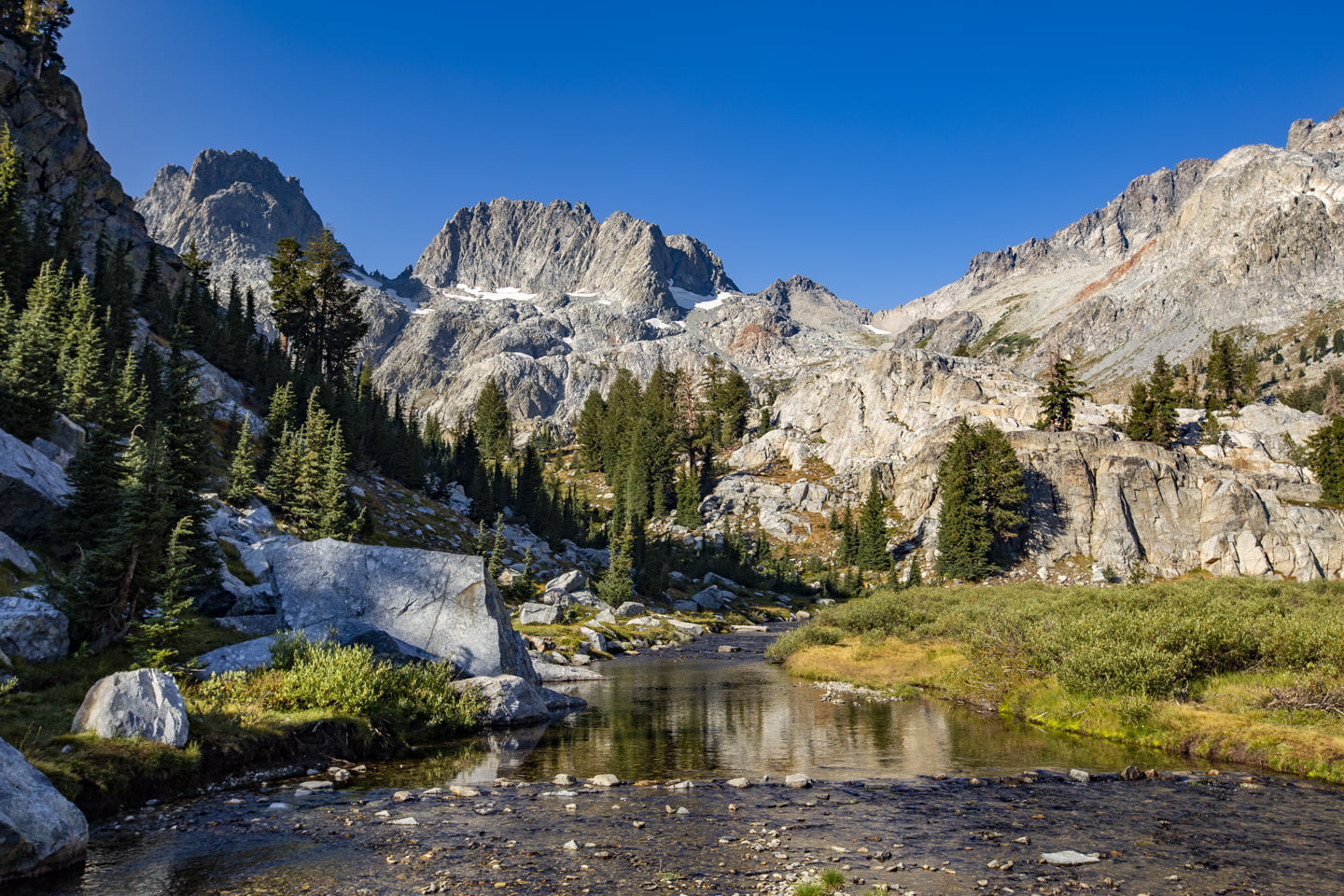
The trail continues to climb steadily with limited shade, especially on a warm summer day, as you make your way along the creek until you reach mile 5.25 where you have a view back across to Shadow Lake. Shortly after you’ll arrive at a junction for a Ediza and Garnet Lake where are you will stay to the left. From mile six, the trail feels a bit like rollercoaster as you hike up a rocky exposed section before descending into a shaded forest and then once again back up.
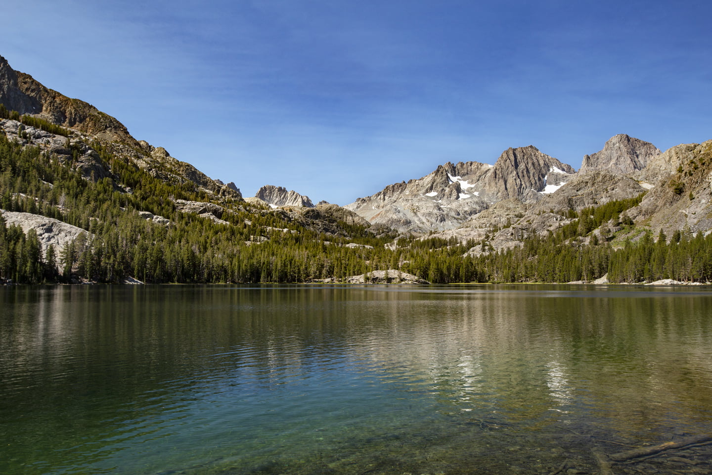
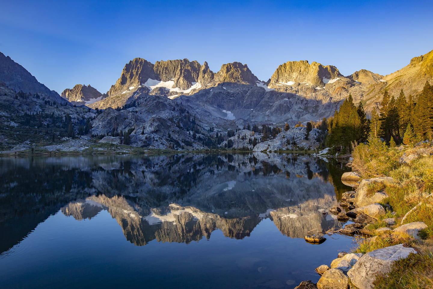
Thankfully, the next section of trail is almost entirely flat as we crossed the creek twice before ascending one final time and arriving at the shore of Ediza Lake. 7.3 miles and 1300 feet of elevation gain. The good news is you’ve arrived at the lake, unfortunately you can’t camp anywhere in this first section so you have to continue walking around the lake before you can set up camp.
We passed a junction at mile 7.5 that heads off to the left to Iceberg Lake. We settled on a campsite at 8 miles, but found out later that better campsites are further down, nearly opposite of where you first reach the lake. Because there is a boulder field on the north side of the lake, it’s best to hike all the way around to the west side to find your camp spot for the night.
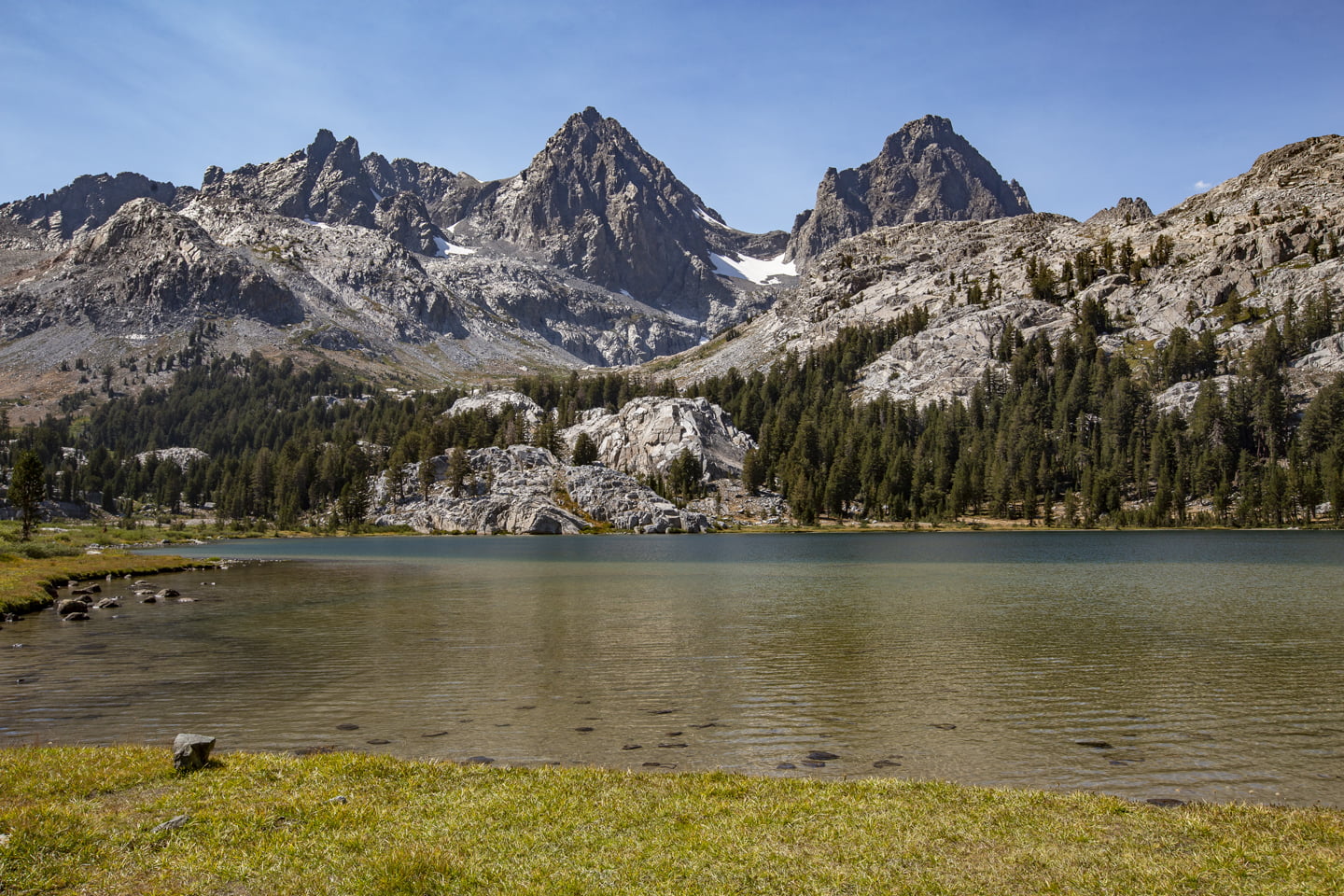
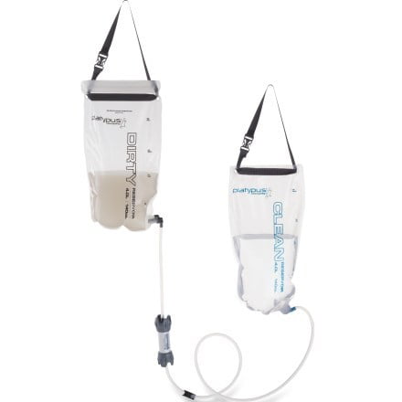
After setting up camp, we headed down to the lake for a swim to cool off. While the water was cold, it was a welcome relief after a long day of hiking. We also spent some time filtering water for the evening and had the chance to try out our new system. Having previously used a pump filter that was gifted to us several years back, we were excited to try out a gravity filter and it was honestly fantastic. Following the swim, we changed, ate dinner, and went to bed for an early sunrise.
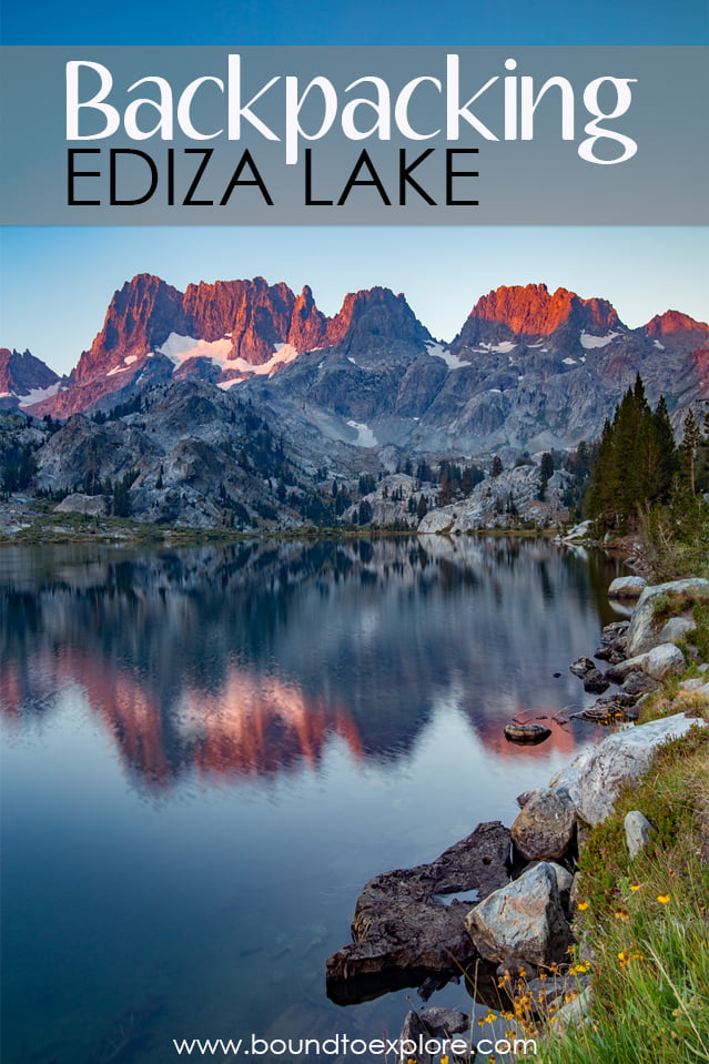
The next morning, Julie and I headed along the west side of the lake for sunrise photos. We awoke to clear skies but the distinct smell of smoke. With California in the midst of record fire season, we knew it was a strong possibility that we might get some drifting smoke. Julie was able to capture a nice bit of alpenglow lighting up the Minarets and then we headed back to pack up camp.
Initially, we had planned on backpacking for three nights and venturing over to a few of the other popular lakes in the area. Unfortunately, Julie came down with a case of altitude sickness and our group decided the best course of action was to descend as she wasn’t feeling any better after a night of sleep. Although she was disappointed, the lakes will always be here for us to come back to and they are best visited when feeling good!
With our packs full, we began to hike out the way we came in. We made a plan to stop at Shadow Lake for a snack break. Julie and her sister Rachelle, who joined us on this hike, took this opportunity to cool off in the lake one last time.

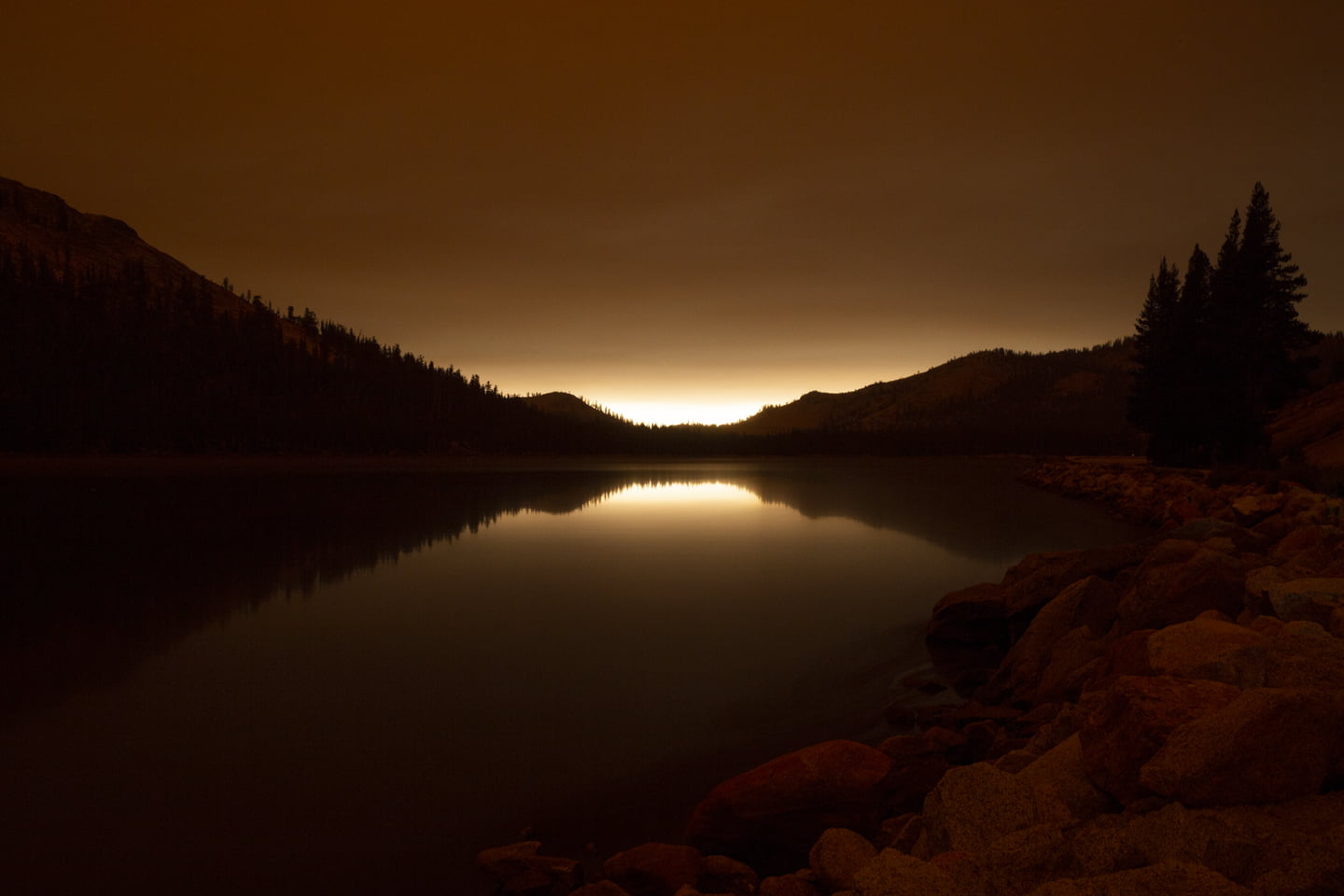
As we left Shadow Lake, we noticed a heavy amount of smoke was descending into the valley we were hiking back to. When we finally arrived back at the car and could check our phones, we discovered that the Creek Fire had started, unbeknownst to us at the time, just the day prior and was moving rapidly. It quickly became clear that our decision to hike out was the right one as smoke had covered much of the skies around us.
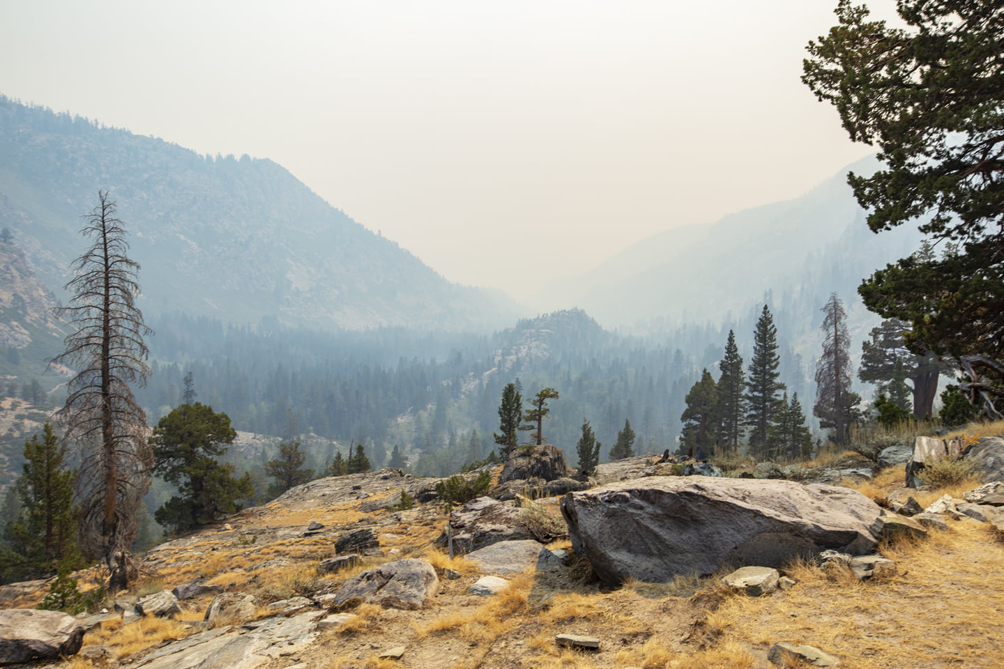
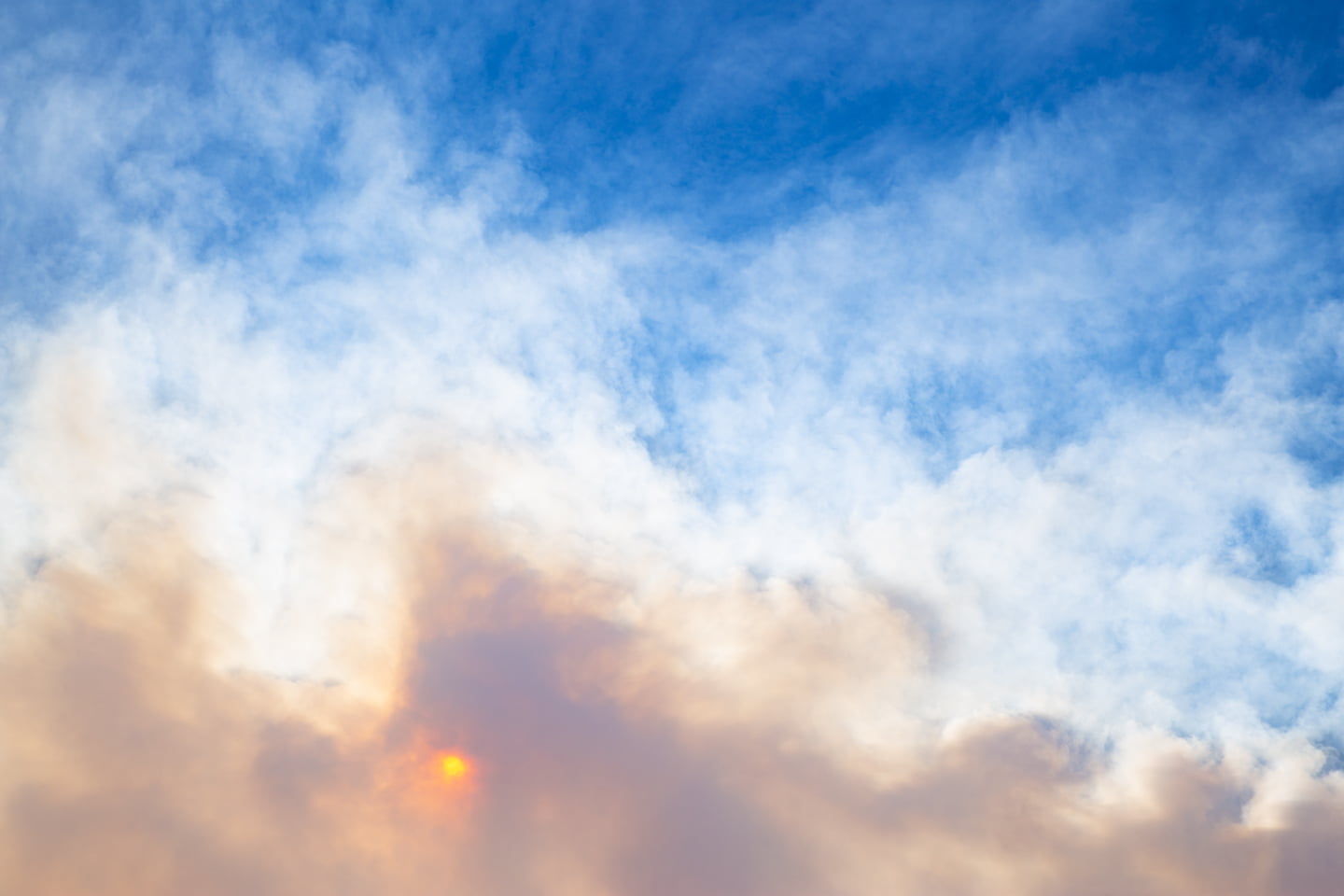
On our drive home through Yosemite that night, we were greeted by an eerie orange haze that felt like we were on another planet. Certainly a strange end to our one night backpacking trip.
Final Thoughts on Backpacking Ediza Lake

Ediza Lake was absolutely beautiful and we are so glad to have been able to spend a night enjoying it! We were both pleasantly surprised at how nice Shadow Lake was as well, and even though camping is not allowed there, it’s a great place to take a break along the way to other lakes in the area. Without question we plan to return to this area again as two big lakes, Thousand Island and Garnet are on our bucket list. If you’re looking for a great place to spend some time in the backcountry, we can’t recommend this area enough!
MORE EASTERN SIERRA HIKES:
Backpacking the 20 Lakes Basin
Hiking the Little Lakes Valley
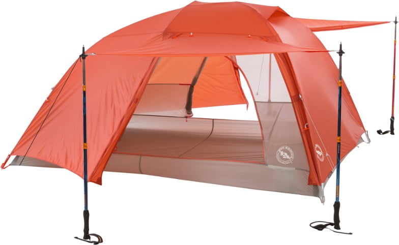
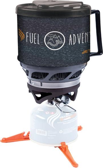
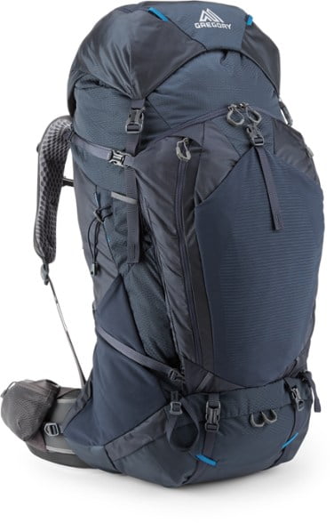
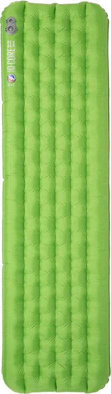
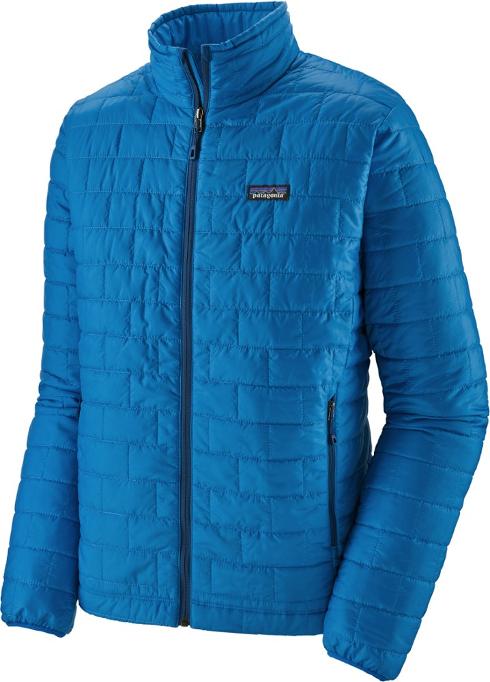
Shop our favorite gear for this adventure:


SAVE THIS POST FOR LATER!
Brian and Julie, our hikes are usually from car to kayak but I do appreciate checking out this Bound to Explore talented duo! Thanks for including me- vicariously -on your artfully detailed adventures ! Happy Trails! Cara
Thanks so much Cara! Appreciate you following along!